𝗪𝗵𝗮𝘁 𝗮𝗿𝗲 𝗧𝗿𝗮𝗶𝗹 𝗠𝗮𝗽𝘀 & 𝗖𝗼𝗺𝗽𝗮𝘀𝘀𝗲𝘀?
Trail maps and compasses are essential tools for navigation in outdoor environments. Trail maps provide detailed information about hiking paths, terrain features, and landmarks, helping users to understand their surroundings. Compasses, on the other hand, are instruments that indicate direction based on the Earth's magnetic field. Together, they form a critical combination for outdoor enthusiasts, hikers, and professionals navigating remote areas.
These tools are primarily used in recreational activities such as hiking, camping, and orienteering. They also serve practical applications for industries like forestry, environmental research, and military operations. Businesses often utilize trail maps and compasses for planning excursions, conducting surveys, and ensuring safety in wilderness settings. The demand for these products is significant in markets emphasizing outdoor activities, adventure tourism, and environmental conservation.
𝗞𝗲𝘆 𝗙𝗲𝗮𝘁𝘂𝗿𝗲𝘀 𝗮𝗻𝗱 𝗦𝗽𝗲𝗰𝗶𝗳𝗶𝗰𝗮𝘁𝗶𝗼𝗻𝘀
Trail maps and compasses come equipped with various features designed to enhance user experience and navigation accuracy. Understanding these specifications can help buyers choose the right products for their needs.
Key specifications include:
1. Material Quality
- Durable, weather-resistant materials for maps
- High-quality magnetic components in compasses
2. Scale and Detail
- Various map scales for different levels of detail
- Clear topographical features for accurate navigation
3. Size and Portability
- Compact designs for easy transport
- Lightweight options for long hikes
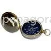
4. Compass Type
- Baseplate compasses for precise navigation
- Lensatic compasses for military applications
5. Ease of Use
- Intuitive designs for quick learning
- Clear markings and instructions for usability
6. Water Resistance
- Waterproof maps for wet conditions
- Weather-resistant compasses for outdoor durability
7. Compatibility with GPS
- Some maps designed to complement GPS devices
- Compasses that align with smartphone navigation apps
8. Additional Features
- Magnetic declination adjustments for precise readings
- Built-in rulers for distance measurement
In summary, understanding the key features and specifications of trail maps and compasses is essential for making informed purchasing decisions.
𝗖𝗼𝗺𝗺𝗼𝗻 𝗔𝗽𝗽𝗹𝗶𝗰𝗮𝘁𝗶𝗼𝗻𝘀 𝗮𝗻𝗱 𝗨𝘀𝗲 𝗖𝗮𝘀𝗲𝘀
Trail maps and compasses find applications across various industries and activities.
1. Outdoor Recreation: Hikers and campers rely on these tools for safe navigation through unfamiliar terrain.
2. Environmental Research: Scientists use trail maps to access study sites and monitor ecological changes over time.
3. Military Operations: Compasses are crucial for strategic navigation and mission planning in field operations.
4. Forestry Management: Professionals utilize maps to manage timber resources and plan sustainable practices.
5. Adventure Tourism: Tour guides use trail maps to enhance the experience of tourists exploring natural landscapes.
6. Search and Rescue: Emergency responders depend on accurate navigation tools to locate missing persons in remote areas.
7. Educational Programs: Schools and organizations teach orienteering skills using trail maps and compasses.
𝗣𝗿𝗼𝗱𝘂𝗰𝘁 𝗩𝗮𝗿𝗶𝗮𝗻𝘁𝘀 𝗮𝗻𝗱 𝗦𝘂𝗯𝗰𝗮𝘁𝗲𝗴𝗼𝗿𝗶𝗲𝘀
Trail maps and compasses come in various forms to cater to different needs.
Standard Trail Maps: These maps provide comprehensive coverage of hiking trails, including elevation changes and landmarks. They are suitable for both casual hikers and serious trekkers.
Topographic Maps: Featuring detailed contour lines, these maps are ideal for outdoor enthusiasts who need to understand terrain elevation and landforms for navigation.
Baseplate Compasses: Designed for general outdoor use, baseplate compasses are user-friendly and perfect for beginners.
Lensatic Compasses: These compasses are more advanced and often used in military and professional settings due to their precision and durability.
Silva Compasses: A popular choice among orienteers, Silva compasses offer features like a sighting mirror and advanced navigation scales.
𝗕𝗲𝗻𝗲𝗳𝗶𝘁𝘀 𝗮𝗻𝗱 𝗔𝗱𝘃𝗮𝗻𝘁𝗮𝗴𝗲𝘀
Using trail maps and compasses offers several advantages for navigation and exploration.
1. Enhanced Safety: Accurate navigation tools reduce the risk of getting lost in unfamiliar areas.
2. Improved Planning: Detailed maps help users plan routes effectively, ensuring a smoother outdoor experience.
3. Skill Development: Learning to use a compass fosters essential outdoor skills and boosts confidence in navigation.
4. Environmental Awareness: Trail maps promote understanding of the natural environment, encouraging responsible outdoor practices.
5. Cost-Effectiveness: Investing in quality maps and compasses can save on costly GPS devices while providing reliable navigation.
6. Versatility: These tools are suitable for a range of outdoor activities, making them valuable for both recreational and professional use.
𝗕𝘂𝘆𝗶𝗻𝗴 𝗚𝘂𝗶𝗱𝗲 𝗳𝗼𝗿 𝗕𝟮𝗕 𝗕𝘂𝘆𝗲𝗿𝘀
When sourcing trail maps and compasses, several factors should be taken into account to ensure the right choice.
1. Quality Assessment: Buyers should evaluate the durability and weather resistance of maps and compasses. Look for reputable brands known for their quality.
2. Supplier Verification: It is important to vet suppliers for reliability and industry experience. Check for customer reviews and previous project references.
3. Pricing and MOQ: Understand the pricing structure and minimum order quantities. Compare different suppliers to find competitive rates.
4. Delivery and Lead Times: Inquire about shipping options and lead times to ensure timely delivery of products, especially for urgent projects.
5. Compliance Requirements: Ensure that products meet relevant industry standards and compliance regulations. Certifications like CE may be necessary depending on the region.
𝗖𝗼𝗺𝗽𝗹𝗶𝗮𝗻𝗰𝗲 𝗮𝗻𝗱 𝗖𝗲𝗿𝘁𝗶𝗳𝗶𝗰𝗮𝘁𝗶𝗼𝗻𝘀
Trail maps and compasses must adhere to various quality standards and compliance requirements.
ISO 9001 is a widely recognized standard that ensures effective quality management systems. Companies producing these products often seek ISO certification to demonstrate their commitment to quality and customer satisfaction.
The CE marking indicates that a product meets European safety, health, and environmental protection standards. For products sold in Europe, this certification is crucial to ensure compliance.
Safety and testing requirements are essential for both maps and compasses. Manufacturers should conduct rigorous testing to guarantee accuracy, durability, and reliability under various conditions.
Regional compliance considerations may vary depending on the market. Buyers should be aware of any local regulations that may affect product sourcing.
𝗪𝗵𝘆 𝗦𝗼𝘂𝗿𝗰𝗲 𝗧𝗿𝗮𝗶𝗹 𝗠𝗮𝗽𝘀 & 𝗖𝗼𝗺𝗽𝗮𝘀𝘀𝗲𝘀 𝗳𝗿𝗼𝗺 𝗣𝗲𝗽𝗮𝗴𝗼𝗿𝗮?
Pepagora provides a trusted platform for sourcing trail maps and compasses with several key advantages.
Verified Supplier Network: Pepagora boasts a comprehensive network of verified suppliers, ensuring buyers can access high-quality products from reputable sources. This network provides peace of mind for B2B buyers seeking reliability.
Streamlined RFQ Process: The platform offers an efficient Request for Quotation process, allowing buyers to easily compare prices and features from multiple suppliers. This simplifies the sourcing process and saves time.
Trade Assurance and Support: Pepagora prioritizes buyer protection through trade assurance programs. This support ensures that transactions are secure and that buyers receive the products they expect.
Regional Coverage: With a strong presence in India, the GCC, and Southeast Asia, Pepagora offers geographic reach that caters to various markets. This expansive coverage allows businesses to source products that best fit their regional needs.