undefined
Topographic Survey Equipment
6 products available
𝗪𝗵𝗮𝘁 𝗮𝗿𝗲 𝗧𝗼𝗽𝗼𝗴𝗿𝗮𝗽𝗵𝗶𝗰 𝗦𝘂𝗿𝘃𝗲𝘆 𝗘𝗾𝘂𝗶𝗽𝗺𝗲𝗻𝘁?
Topographic survey equipment is essential for capturing the physical features of a land area, including its elevation, contours, and natural or artificial structures. This equipment is designed to gather precise data that can be used in various applications such as construction, land development, and environmental studies. The data collected helps in creating detailed maps and models that aid in planning and decision-making processes.
The primary uses of topographic survey equipment span across various industries, including civil engineering, architecture, and environmental management. These tools enable professionals to assess land use, design infrastructure projects, and conduct environmental impact assessments. By providing accurate measurements and detailed representations of the landscape, businesses can enhance their project outcomes and ensure compliance with regulatory requirements.
In today's market, topographic survey equipment plays a crucial role in the growing demand for accurate land surveys. With the increasing complexity of construction projects and the need for sustainable development, the relevance of this equipment has surged. Companies are now looking for advanced technologies that can improve efficiency and data accuracy in surveying processes.
𝗞𝗲𝘆 𝗙𝗲𝗮𝘁𝘂𝗿𝗲𝘀 𝗮𝗻𝗱 𝗦𝗽𝗲𝗰𝗶𝗳𝗶𝗰𝗮𝘁𝗶𝗼𝗻𝘀
Topographic survey equipment comes with a range of features and specifications that enhance its functionality and accuracy. These specifications are essential for users to understand as they determine the equipment's suitability for specific survey tasks.
Key specifications include:
1. Measurement Accuracy
- High precision in distance and elevation measurements
- Typically within a range of 1-5 mm, depending on equipment type
2. Range of Operation
- Capability to survey large distances
- Effective range can vary from a few meters to several kilometers
3. Data Collection Method
- Utilizes methods such as GPS, total stations, and laser scanning
- Allows for real-time data gathering for immediate analysis
4. Processing Software Compatibility
- Integration with software for data analysis and mapping
- Popular software options include AutoCAD and GIS systems
5. Battery Life
- Extended operational time on a single charge
- Ranges from 6 to 12 hours, depending on usage
6. Build Quality
- Rugged design for durability in various environmental conditions
- Water and dust resistance ratings often meet IP standards
7. Weight and Portability
- Lightweight designs for ease of transport
- Portable units often weigh between 1 to 5 kg
8. Communication Interfaces
- Options for Bluetooth and Wi-Fi connectivity for data transfer
- Ensures easy integration with mobile devices and computers
In summary, understanding these specifications helps businesses select the most appropriate topographic survey equipment for their needs, ensuring optimal performance and accuracy in surveying tasks.
𝗖𝗼𝗺𝗺𝗼𝗻 𝗔𝗽𝗽𝗹𝗶𝗰𝗮𝘁𝗶𝗼𝗻𝘀 𝗮𝗻𝗱 𝗨𝘀𝗲 𝗖𝗮𝘀𝗲𝘀
Topographic survey equipment has diverse applications across multiple industries, making it a critical tool for various professionals.
1. Civil Engineering: In civil engineering, this equipment is used for site analysis and preparation. Engineers rely on accurate topographic data to design roads, bridges, and other infrastructure.
2. Architecture: Architects utilize topographic surveys to inform building designs. Understanding the land's contours and features helps in creating structures that harmonize with the environment.
3. Environmental Management: Environmental specialists use topographic surveys to assess land for conservation efforts and to monitor changes in land use over time.
4. Mining: The mining industry employs topographic surveys to map terrain and identify resources. Accurate data is crucial for planning extraction processes and minimizing environmental impact.
5. Agriculture: Farmers and agronomists use topographic data to optimize land use and manage irrigation systems. Understanding the land's elevation can improve crop yields.
6. Real Estate: Real estate developers conduct topographic surveys to evaluate land for potential development. This data aids in understanding zoning and compliance with local regulations.
7. Surveying: Surveyors rely on topographic survey equipment to create detailed maps for various purposes, including legal property boundaries and land assessments.
𝗣𝗿𝗼𝗱𝘂𝗰𝘁 𝗩𝗮𝗿𝗶𝗮𝗻𝘁𝘀 𝗮𝗻𝗱 𝗦𝘂𝗯𝗰𝗮𝘁𝗲𝗴𝗼𝗿𝗶𝗲𝘀
Topographic survey equipment is available in various forms to cater to different surveying needs and environments.
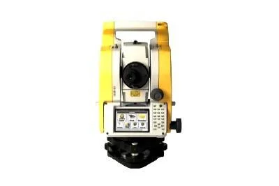
Total Stations: These instruments combine an electronic theodolite with an electronic distance measuring device. They are ideal for precise angle and distance measurements, making them suitable for construction and engineering projects.
GPS Survey Equipment: Global Positioning System (GPS) devices provide high-accuracy location data. They are widely used in large-scale surveys, allowing for quick and efficient data collection over extensive areas.
Laser Scanners: Laser scanning technology captures detailed 3D representations of landscapes. This equipment is beneficial for complex topographies and urban environments, where high detail is essential.
Drones: Unmanned aerial vehicles are increasingly used for topographic surveys. They can cover large areas quickly and gather high-resolution imagery, making them ideal for environmental and agricultural assessments.
𝗕𝗲𝗻𝗲𝗳𝗶𝘁𝘀 𝗮𝗻𝗱 𝗔𝗱𝘃𝗮𝗻𝘁𝗮𝗴𝗲𝘀
Investing in topographic survey equipment offers several advantages that enhance operational efficiency and data quality.
1. Increased Accuracy: High-precision measurements reduce errors in surveying, leading to more reliable data for planning and execution.
2. Cost-Effective Solutions: Efficient data collection methods minimize labor costs and time spent on surveys, providing better value for investments.
3. Enhanced Productivity: Quick data acquisition and processing capabilities streamline workflows, enabling faster project completion.
4. Versatility: This equipment can be used for various applications across multiple industries, making it a valuable asset for diverse businesses.
5. Improved Decision-Making: Accurate topographic data supports informed decision-making, which is critical for project success and compliance.
6. Advanced Technology Integration: Modern topographic survey equipment often integrates with advanced software, enhancing data analysis and visualization.
𝗕𝘂𝘆𝗶𝗻𝗴 𝗚𝘂𝗶𝗱𝗲 𝗳𝗼𝗿 𝗕𝟮𝗕 𝗕𝘂𝘆𝗲𝗿𝘀
When sourcing topographic survey equipment, there are several key factors to consider to ensure you select the best options for your business needs.
1. Quality Assessment: Ensure that the equipment meets industry standards for accuracy and reliability. Look for certifications and customer reviews that demonstrate product quality.
2. Supplier Verification: Vet suppliers thoroughly to confirm their credibility and reputation in the market. Check for previous customer feedback and their track record in delivering quality products.
3. Pricing and MOQ: Understand the pricing structure and minimum order quantities (MOQ) required by suppliers. This will help in budgeting and planning your purchases effectively.
4. Delivery and Lead Times: Inquire about the expected delivery times and logistics involved. Timely delivery is crucial for maintaining project schedules.
5. Compliance Requirements: Ensure that the equipment complies with relevant regulations and standards in your region. This can include safety certifications and environmental regulations.
𝗖𝗼𝗺𝗽𝗹𝗶𝗮𝗻𝗰𝗲 𝗮𝗻𝗱 𝗖𝗲𝗿𝘁𝗶𝗳𝗶𝗰𝗮𝘁𝗶𝗼𝗻𝘀
Topographic survey equipment must adhere to various compliance and certification standards to ensure safety and reliability.
Quality standards such as ISO 9001 ensure that manufacturers maintain consistent quality management systems. This is critical for ensuring that the equipment performs reliably and meets user expectations.
Industry certifications like CE mark indicate that the equipment complies with European safety and environmental protection requirements. This certification is essential for equipment to be sold in the European market.
Additionally, safety and testing requirements are crucial for ensuring that the equipment operates safely in various environments. Manufacturers must conduct rigorous testing to meet these standards.
Regional compliance considerations may vary depending on local laws and regulations. It is important for buyers to be aware of these requirements to avoid potential legal issues.
𝗪𝗵𝘆 𝗦𝗼𝘂𝗿𝗰𝗲 𝗧𝗼𝗽𝗼𝗴𝗿𝗮𝗽𝗵𝗶𝗰 𝗦𝘂𝗿𝘃𝗲𝘆 𝗘𝗾𝘂𝗶𝗽𝗺𝗲𝗻𝘁 𝗳𝗿𝗼𝗺 𝗣𝗲𝗽𝗮𝗴𝗼𝗿𝗮?
Pepagora offers a comprehensive and trusted platform for sourcing topographic survey equipment, providing several key advantages for B2B buyers.
Verified Supplier Network: Pepagora connects buyers with a network of verified suppliers, ensuring that you can source high-quality equipment from reputable manufacturers. This verification process helps build trust and confidence in your purchasing decisions.
Streamlined RFQ Process: The platform simplifies the request for quotation (RFQ) process, allowing buyers to easily compare offers from multiple suppliers. This efficiency saves time and facilitates better negotiation outcomes.
Trade Assurance and Support: Pepagora provides trade assurance, protecting buyers from potential risks associated with transactions. This support includes assistance with disputes and ensuring that orders are fulfilled as promised.
Regional Coverage: With a focus on regions including India, the GCC, and Southeast Asia, Pepagora offers extensive geographic reach. This allows buyers to access a diverse range of suppliers and products tailored to their specific regional needs.
Newly Added


Recently Added
Allys Hardware And Tools Private Limited
Professional 500W Hammer Drill 10mm Chuck 2800 RPM 47600 BPM
Professional 550W Rotary Hammer Drill 13mm Chuck 2800 RPM 47600 BPM
Industrial High Speed Rotary Hammer Drill 520W 2800 RPM 10mm Steel
A Blue Hill Granites (India) Private Limited
Premium Grey Granite For Interior Construction And Monuments
Construction Granite Cut To Size Rough Rubbed Durable
Premium Grey Calcite Marble Mantri Big Slab Polished OEM New
Gubbi Enterprises
Concrete Testing Slump Cone For ASTM IS Standards 38mm Aggregate
Industrial Sieve Shaker Machine For Accurate Dry Particle Analysis
Industrial Vibrating Table For Material Compaction In Packaging And Testing
Askib Engineers Private Limited
Industrial Brinell Microscope 25X Magnification 0.01mm LC NABL Certified
NABL Certified Rubber Bellows for Hardness Testers 8 Inch 12 Inch
NABL Certified Steel Ball Indentors For Rockwell Brinell Hardness Testers
B. E. P. Edu World
Child CPR Training Manikin with Light Indicators for Medical Education
Nurse Basic Practice Teaching Model BEP 405 5 Part Anatomical Training Tool
CPR Training Manikin with Electronic Monitoring Meets AHA Standards
Alpha Engineering Equipments
Electronic Theodolites For Surveying And Construction Professionals
Premium Bitumen Testing Machines For Construction Materials Analysis
Aggregate Testing Machines For Construction Materials Analysis
Bellstone Hi-Tech International
Reversible Concrete Mixers For Construction Projects With High Performance
Industrial Material Handling Equipment For Warehouses And Construction
Heavy Duty Single Drum Roller For Soil And Asphalt Compaction
Kusaba Engineers Pvt Ltd
Industrial Automation Precision Tilt Sensors With IP68 Protection
High Precision Tilt Compensated Magnetometer Compass Module with RS 232/422/485
Industrial Automation Absolute Optical Encoders For Precise Position Tracking
Why Businesses Trust Pepagora
Thousands of companies trust Pepagora to source smarter and sell faster
Expand Your Sales Globally
25000+Products listed.Get discovered by global buyers
Tools to boost visibility
Build your own catalog

Source Smarter,Grow Faster
4000+Active RFQs
100+ Countries served
Easy Sourcing Tools
