undefined
Land Surveying Drones
5 products available
𝗪𝗵𝗮𝘁 𝗮𝗿𝗲 𝗟𝗮𝗻𝗱 𝗦𝘂𝗿𝘃𝗲𝘆𝗶𝗻𝗴 𝗗𝗿𝗼𝗻𝗲𝘀?
Land surveying drones are advanced aerial vehicles equipped with high-resolution cameras and sensors to capture detailed images and data for mapping and surveying purposes. These drones utilize cutting-edge technology to create accurate topographic maps, 3D models, and geographic information systems (GIS) data. They are designed to operate autonomously or can be piloted remotely, providing flexibility and efficiency in surveying tasks.
The primary uses of land surveying drones include construction site analysis, land use planning, environmental monitoring, and agricultural assessments. Businesses across various sectors, such as real estate, construction, and environmental management, leverage these drones to enhance productivity and reduce costs associated with traditional surveying methods. The increasing demand for accurate data and the need for rapid assessments are driving the growth of this technology in the market.
As industries increasingly adopt drone technology, the relevance of land surveying drones continues to rise. The market is experiencing significant growth, fueled by advancements in drone capabilities and regulatory support for commercial applications. Companies that utilize these drones benefit from improved accuracy, reduced labor costs, and faster project completion times, solidifying the technology's position in the surveying landscape.
𝗞𝗲𝘆 𝗙𝗲𝗮𝘁𝘂𝗿𝗲𝘀 𝗮𝗻𝗱 𝗦𝗽𝗲𝗰𝗶𝗳𝗶𝗰𝗮𝘁𝗶𝗼𝗻𝘀
Land surveying drones come with a variety of features designed to meet the needs of professionals in the field. These specifications ensure that users can collect high-quality data efficiently and accurately.
Key specifications include:
1. Flight Time
- Typical flight times range from 20 to 60 minutes, depending on the drone model and payload.
2. Payload Capacity
- Drones can carry payloads of up to 5 kg, accommodating various sensors and cameras.
3. Camera Resolution
- High-resolution cameras typically range from 12 MP to 100 MP, enabling detailed image capture.
4. Range of Operation
- Most drones operate within a range of 2 km to 5 km, allowing for extensive coverage of large areas.
5. GPS Accuracy
- Drones utilize GPS systems with accuracy levels of 1 cm to 5 cm, essential for precise surveying tasks.
6. Software Compatibility
- Many drones are compatible with popular mapping software, facilitating data processing and analysis.
7. Battery Type
- Lithium polymer batteries are commonly used, providing efficient power management for extended flights.
8. Construction Materials
- Drones are typically constructed from lightweight materials like carbon fiber or plastic, enhancing durability and maneuverability.
In summary, land surveying drones are equipped with advanced features and specifications that make them indispensable tools for modern surveying practices.
𝗖𝗼𝗺𝗺𝗼𝗻 𝗔𝗽𝗽𝗹𝗶𝗰𝗮𝘁𝗶𝗼𝗻𝘀 𝗮𝗻𝗱 𝗨𝘀𝗲 𝗖𝗮𝘀𝗲𝘀
Land surveying drones have diverse applications across multiple industries.
1. Construction: Drones are used for site surveys, progress tracking, and site inspections, providing real-time data that helps in project management.
2. Agriculture: Farmers utilize drones for crop monitoring, soil analysis, and precision agriculture, enabling better yield management and resource allocation.
3. Real Estate: Drones are employed for property assessments, aerial photography, and marketing, helping real estate agents showcase properties effectively.
4. Environmental Monitoring: Drones assist in tracking environmental changes, mapping vegetation, and assessing wildlife habitats, contributing to conservation efforts.
5. Mining: In the mining industry, drones are used for surveying land, monitoring stockpiles, and ensuring safety compliance on mining sites.
6. Utilities: Drones facilitate inspections of power lines, pipelines, and infrastructure, improving maintenance efficiency and reducing downtime.
7. Archaeology: Archaeologists use drones for site documentation and mapping, enhancing research capabilities and site analysis.
𝗣𝗿𝗼𝗱𝘂𝗰𝘁 𝗩𝗮𝗿𝗶𝗮𝗻𝘁𝘀 𝗮𝗻𝗱 𝗦𝘂𝗯𝗰𝗮𝘁𝗲𝗴𝗼𝗿𝗶𝗲𝘀
Land surveying drones offer a range of variants to cater to specific user needs and applications.
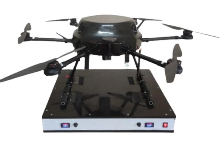
Surveyor Drone Model A
This model features a high-resolution camera and advanced GPS capabilities, making it ideal for detailed topographic mapping and large-scale surveying projects.
Surveyor Drone Model B
Designed for agricultural applications, this variant includes specialized sensors for crop health monitoring and soil analysis, providing actionable insights for farmers.
Surveyor Drone Model C
This model is equipped with thermal imaging capabilities, making it suitable for environmental monitoring and infrastructure inspections, allowing users to identify issues that may not be visible to the naked eye.
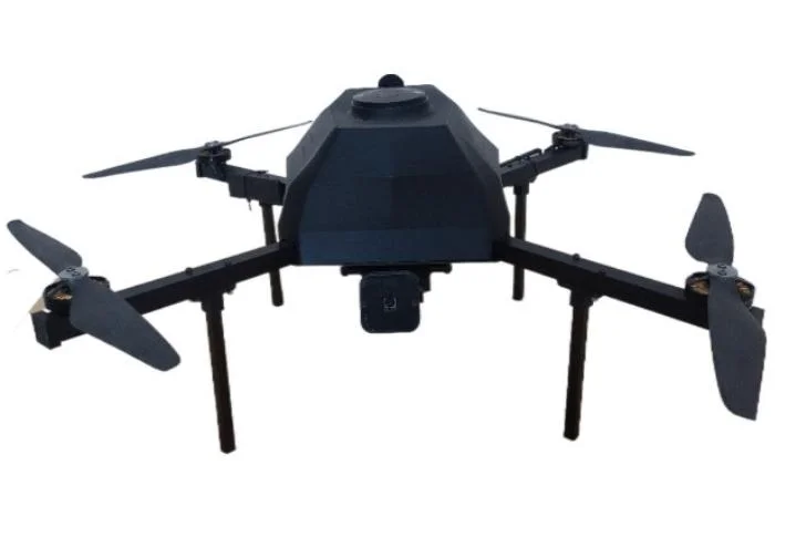
Surveyor Drone Model D
With an extended flight time and robust payload capacity, this drone is perfect for large construction sites requiring extensive data collection over long periods.
𝗕𝗲𝗻𝗲𝗳𝗶𝘁𝘀 𝗮𝗻𝗱 𝗔𝗱𝘃𝗮𝗻𝘁𝗮𝗴𝗲𝘀
Land surveying drones offer numerous benefits that enhance operational efficiency and data accuracy.
Key benefits include:
1. Enhanced Accuracy: Drones provide high-resolution data and precise measurements, reducing errors typical of traditional surveying methods.
2. Cost-Effectiveness: By automating data collection, drones significantly lower labor costs and project timelines, offering a better return on investment.
3. Improved Safety: Drones can access hazardous or hard-to-reach areas without putting personnel at risk, increasing overall workplace safety.
4. Rapid Data Collection: Drones can cover large areas in a fraction of the time it takes for traditional surveys, expediting project workflows.
5. Versatility: These drones can be equipped with various sensors and cameras, making them suitable for different applications across industries.
6. Real-Time Data Access: Users can receive immediate data, allowing for timely decision-making and adjustments during projects.
𝗕𝘂𝘆𝗶𝗻𝗴 𝗚𝘂𝗶𝗱𝗲 𝗳𝗼𝗿 𝗕𝟮𝗕 𝗕𝘂𝘆𝗲𝗿𝘀
When sourcing land surveying drones, it is essential for buyers to consider specific factors to ensure they choose the right equipment for their needs.
1. Quality Assessment: Evaluate the build quality, camera specifications, and software compatibility to ensure the drone meets industry standards for surveying.
2. Supplier Verification: Conduct due diligence by checking supplier credentials, customer reviews, and product warranties to select a reputable manufacturer.
3. Pricing and MOQ: Understand the cost structure and minimum order quantities to align with budget constraints and project requirements.
4. Delivery and Lead Times: Consider logistics, including shipping times and delivery methods, to ensure the drones arrive when needed for project timelines.
5. Compliance Requirements: Familiarize yourself with regulatory standards and certifications, such as CE, to ensure the drones meet local laws and industry guidelines.
𝗖𝗼𝗺𝗽𝗹𝗶𝗮𝗻𝗰𝗲 𝗮𝗻𝗱 𝗖𝗲𝗿𝘁𝗶𝗳𝗶𝗰𝗮𝘁𝗶𝗼𝗻𝘀
Land surveying drones must adhere to various industry standards and regulations to ensure safety and quality. ISO 9001 is a standard that outlines quality management systems, ensuring that manufacturers maintain high production standards.
In addition, industry certifications like CE demonstrate compliance with European safety and environmental requirements, making such drones suitable for use in various markets.
Safety testing is also crucial, ensuring that drones can operate reliably in different conditions. Regional compliance considerations may vary, so it is essential for buyers to consult local regulations governing drone usage and certification before making a purchase.
𝗪𝗵𝘆 𝗦𝗼𝘂𝗿𝗰𝗲 𝗟𝗮𝗻𝗱 𝗦𝘂𝗿𝘃𝗲𝘆𝗶𝗻𝗴 𝗗𝗿𝗼𝗻𝗲𝘀 𝗳𝗿𝗼𝗺 𝗣𝗲𝗽𝗮𝗴𝗼𝗿𝗮?
Pepagora provides a trusted platform for sourcing land surveying drones, offering several key advantages to B2B buyers.
The verified supplier network includes reputable manufacturers who meet high quality standards, ensuring that buyers receive reliable products. Each supplier undergoes thorough vetting to guarantee their credentials and product reliability.
The streamlined RFQ process allows buyers to request quotations easily and compare options, making it simpler to find the best deals without extensive research.
With trade assurance and support, Pepagora offers buyer protection and assistance throughout the purchasing process, giving customers confidence in their transactions.
Furthermore, Pepagora's regional coverage spans India, the GCC, and Southeast Asia, allowing buyers to access a wide range of products tailored to their specific market needs. This extensive reach ensures that customers can find the right land surveying drones for their operations, regardless of location.
Newly Added


Recently Added
MERLINHAWK AEROSPACE PVT. LTD.
Merlinhawks Flight Data Transfer Unit ARINC 717/573 CompactFlash Mi 17 IL 76 IL 78
Merlinhawks FDAU/FDRU Flight Data Recorder System for Mi 17 IV Helicopters with PlaneView Software
FDRU Rear View Flight Data Replay Unit For Mi 17 Helicopters With FDAU PlaneView Integration
CALIBER INTERCONNECT SOLUTIONS PVT LTD
AI Driven Autonomous Mobile Robots For Warehouse Automation & Material Handling
Industrial AI Driven Robotic Handlers For Manufacturing & Logistics Automation
Residential & Commercial 12kW Solar Grid Tied Inverter with MPPT & Monitoring
Garudan Unmanned System Pvt Ltd
VAANVILI AG10 Agriculture Drone 10 Litre Pesticide Spraying Crop Monitoring
Professional Surveillance Mapping Inspection Drone VAANVILI SQ1 Carbon Fibre
VAANVILI IQ2 5G LTE Cloud Controlled Mapping Drone For Autonomous Inspection
Why Businesses Trust Pepagora
Thousands of companies trust Pepagora to source smarter and sell faster
Expand Your Sales Globally
25000+Products listed.Get discovered by global buyers
Tools to boost visibility
Build your own catalog

Source Smarter,Grow Faster
4000+Active RFQs
100+ Countries served
Easy Sourcing Tools
