undefined
GPS Survey Equipment
4 products available
𝗪𝗵𝗮𝘁 𝗮𝗿𝗲 𝗚𝗣𝗦 𝗦𝘂𝗿𝘃𝗲𝘆 𝗘𝗾𝘂𝗶𝗽𝗺𝗲𝗻𝘁?
GPS survey equipment refers to a range of technologies that utilize Global Positioning System (GPS) satellites to determine precise locations on Earth. This equipment includes devices such as GPS receivers, antennas, and software solutions that process and analyze data. GPS survey equipment is designed to achieve high accuracy in positioning, which is critical for tasks such as land surveying, construction, and mapping.
The primary uses of GPS survey equipment span various industries, including civil engineering, agriculture, mining, and environmental monitoring. Businesses employ this technology for land development, topographic surveys, and creating Geographic Information Systems (GIS). GPS survey equipment plays a significant role in enhancing productivity and accuracy, reducing the time taken for fieldwork, and minimizing human errors.
With the growing demand for accurate data in project planning and execution, the GPS survey equipment market continues to expand. Technological advancements have made these tools more accessible and user-friendly, further increasing their relevance in various sectors. The integration of GPS with other technologies, such as Geographic Information Systems and remote sensing, has opened new avenues for applications and improved operational efficiency.
𝗞𝗲𝘆 𝗙𝗲𝗮𝘁𝘂𝗿𝗲𝘀 𝗮𝗻𝗱 𝗦𝗽𝗲𝗰𝗶𝗳𝗶𝗰𝗮𝘁𝗶𝗼𝗻𝘀
GPS survey equipment comes with a variety of features and specifications that determine its effectiveness in various applications. Understanding these specifications is crucial for selecting the right equipment for specific needs.
Key specifications include:
1. Accuracy
- Typically ranges from centimeters to millimeters, depending on the equipment type and settings.
2. Frequency
- Dual-frequency or multi-frequency options are available, allowing for better signal reception and accuracy.
3. Signal Tracking
- Capable of tracking multiple satellite constellations, including GPS, GLONASS, Galileo, and BeiDou for improved reliability.
4. Data Logging Capacity
- Varies by model, with options for internal storage or external data transfer capabilities.
5. Battery Life
- Usually ranges from 8 to 24 hours, depending on usage and settings.
6. Operating Temperature
- Designed to function in various environments, typically rated for -20°C to 50°C.
7. Weight
- Lightweight models available, usually ranging from 1 to 3 kg for portability.
8. Connectivity
- Options for Bluetooth, Wi-Fi, and USB for easy data transfer and device integration.
These specifications are vital for ensuring the equipment meets the specific demands of surveying tasks, thus enhancing overall productivity.
𝗖𝗼𝗺𝗺𝗼𝗻 𝗔𝗽𝗽𝗹𝗶𝗰𝗮𝘁𝗶𝗼𝗻𝘀 𝗮𝗻𝗱 𝗨𝘀𝗲 𝗖𝗮𝘀𝗲𝘀
GPS survey equipment serves multiple industries, each with unique applications that leverage the technology's precision and reliability.
1. Construction: In construction, GPS survey equipment is utilized for site layout, monitoring project progress, and ensuring structural accuracy. This helps in reducing delays and improving overall project management.
2. Agriculture: Farmers use GPS technology for precision farming, allowing them to optimize planting, fertilizing, and irrigation. This leads to improved crop yields and efficient resource use.
3. Mining: In the mining sector, GPS survey equipment aids in site exploration and resource allocation. Accurate mapping ensures effective extraction processes and compliance with safety regulations.
4. Environmental Monitoring: Environmental scientists use GPS equipment to track changes in land use, monitor ecosystems, and assess environmental impacts. This data is crucial for conservation efforts.
5. Urban Planning: City planners employ GPS survey equipment for land use planning, infrastructure development, and transportation mapping. Accurate data supports informed decision-making.
6. Telecommunications: GPS technology is used to establish and maintain cell tower locations and optimize network coverage. This enhances communication services in urban and rural areas.
7. Disaster Management: In disaster response, GPS survey equipment is essential for mapping affected areas and coordinating relief efforts. Accurate location data improves response times.
𝗣𝗿𝗼𝗱𝘂𝗰𝘁 𝗩𝗮𝗿𝗶𝗮𝗻𝘁𝘀 𝗮𝗻𝗱 𝗦𝘂𝗯𝗰𝗮𝘁𝗲𝗴𝗼𝗿𝗶𝗲𝘀
GPS survey equipment is diverse, offering various models to cater to different surveying needs and budgets.
Rover Units
Rover units are portable GPS devices used in the field for real-time data collection. They are equipped with advanced signal processing capabilities and are ideal for dynamic surveying tasks.
Base Stations
Base stations serve as fixed reference points that enhance the accuracy of GPS data collected by rover units. They are essential for differential GPS applications, improving overall precision.
Trimble GNSS Receivers
These high-performance receivers are designed for construction and surveying applications, offering real-time kinematic positioning and robust data logging capabilities.
𝗕𝗲𝗻𝗲𝗳𝗶𝘁𝘀 𝗮𝗻𝗱 𝗔𝗱𝘃𝗮𝗻𝘁𝗮𝗴𝗲𝘀
Investing in GPS survey equipment brings several advantages that enhance operational efficiency and accuracy.
1. Increased Accuracy: GPS survey equipment provides high precision in location data, which is crucial for various applications including construction and mapping.
2. Time Efficiency: The use of GPS technology significantly reduces the time needed for data collection in the field, leading to quicker project completion.
3. Cost-Effective: Over time, the accuracy and efficiency gained from using GPS survey equipment can lead to cost savings in labor and materials.
4. Enhanced Data Analysis: Advanced software solutions integrated with GPS equipment allow for detailed data analysis and reporting, improving decision-making processes.
5. Improved Safety: With precise location data, projects can be better planned and executed, reducing risks associated with surveying and construction tasks.
6. Versatile Applications: GPS survey equipment can be utilized across various industries, making it a valuable investment for businesses in different sectors.
𝗕𝘂𝘆𝗶𝗻𝗴 𝗚𝘂𝗶𝗱𝗲 𝗳𝗼𝗿 𝗕𝟮𝗕 𝗕𝘂𝘆𝗲𝗿𝘀
When sourcing GPS survey equipment, several key factors should be considered to ensure the right fit for your business needs.
1. Quality Assessment: Look for industry standards and customer reviews to evaluate the quality and reliability of the equipment. Quality assurance is critical for performance and longevity.
2. Supplier Verification: Vet suppliers thoroughly to ensure they have a track record of providing reliable products and services. Check for certifications and customer testimonials.
3. Pricing and MOQ: Understand the pricing structure and minimum order quantities (MOQ) to align with your budget and project requirements. Consider bulk purchasing options for cost savings.
4. Delivery and Lead Times: Discuss delivery options and lead times with suppliers to ensure that equipment arrives when needed. Timely delivery can be crucial for project timelines.
5. Compliance Requirements: Ensure that the equipment meets necessary regulatory and compliance standards in your region. This is important for safety and legal considerations.
𝗖𝗼𝗺𝗽𝗹𝗶𝗮𝗻𝗰𝗲 𝗮𝗻𝗱 𝗖𝗲𝗿𝘁𝗶𝗳𝗶𝗰𝗮𝘁𝗶𝗼𝗻𝘀
GPS survey equipment must adhere to several quality standards and certifications to ensure reliability and safety.
Relevant quality standards such as ISO 9001 indicate that manufacturers have implemented effective quality management systems. This is essential for maintaining consistent product quality and customer satisfaction.
Industry certifications like CE mark confirm that the equipment meets European health, safety, and environmental protection standards. This certification is crucial for ensuring that the equipment can be legally sold and used in Europe.
Safety and testing requirements vary by region and application. Manufacturers must conduct thorough testing to ensure that their products perform reliably in varying conditions.
Regional compliance considerations are also important. Different countries may have specific regulations governing the use of GPS technology, and compliance with these regulations is necessary for market entry.
𝗪𝗵𝘆 𝗦𝗼𝘂𝗿𝗰𝗲 𝗚𝗣𝗦 𝗦𝘂𝗿𝘃𝗲𝘆 𝗘𝗾𝘂𝗶𝗽𝗺𝗲𝗻𝘁 𝗳𝗿𝗼𝗺 𝗣𝗲𝗽𝗮𝗴𝗼𝗿𝗮?
Pepagora provides a trusted platform for sourcing GPS survey equipment with several key advantages.
Verified Supplier Network: Pepagora ensures that all suppliers are thoroughly vetted, providing buyers with confidence in the quality of the products offered.
Streamlined RFQ Process: The request for quotation (RFQ) process on Pepagora is designed to be simple and efficient. Buyers can quickly receive multiple quotations, allowing for informed decision-making.
Trade Assurance and Support: Buyers benefit from trade assurance measures that protect their investments. Pepagora provides support throughout the purchasing process, ensuring a smooth experience.
Regional Coverage: With a strong presence in India, the GCC, and Southeast Asia, Pepagora offers extensive geographic reach. This allows businesses to access a wide range of GPS survey equipment tailored to their regional needs.
Newly Added


Recently Added
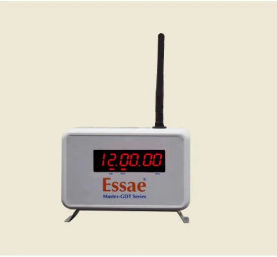
Essae - Teraoka Private Limited
POS 415 15 Inch Touchscreen System with Windows POS Ready 7
Retail POS System 15 Inch Touchscreen 320GB Storage Windows Embedded
POS 315 All in One System with Integrated Printer and Touch Display
A One Associates
Professional Total Station Land Survey Services For Construction And Mining
Professional Topographical Land Survey Services For Accurate Terrain Mapping
Powerline Survey Services Real Time Data Plotting Quality Checks
A. K. Rampurawala & Sons
Fleet Management GPS Tracking Device Real Time Location Fuel Monitoring
Automatic Level Instrument 20X 32X Magnification 2mm 1mm/km Accuracy
Leica TS07 Total Station High Precision Surveying 2 5 Arc Second Accuracy
Why Businesses Trust Pepagora
Thousands of companies trust Pepagora to source smarter and sell faster
Expand Your Sales Globally
25000+Products listed.Get discovered by global buyers
Tools to boost visibility
Build your own catalog

Source Smarter,Grow Faster
4000+Active RFQs
100+ Countries served
Easy Sourcing Tools
