undefined

Similar Products


Description
Our professional land survey services provide precise geospatial data and boundary information critical for successful project execution. We combine advanced surveying technology w...
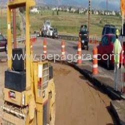
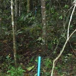
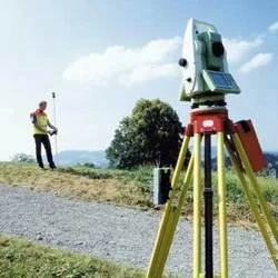
Our professional land survey services provide precise geospatial data and boundary information critical for successful project execution. We combine advanced surveying technology with extensive domain expertise to deliver accurate measurements, topographic mapping, and property boundary identification. Our team utilizes state-of-the-art equipment including GPS systems, total stations, and modern surveying instruments to capture comprehensive site data. We serve construction companies, real estate developers, government agencies, and engineering firms requiring reliable land information for planning and development purposes. Our services include boundary surveys, topographic mapping, construction staking, and land title surveys, all performed with meticulous attention to detail and regulatory compliance.

These survey services are extensively used across multiple industries including commercial real estate development, transportation infrastructure projects, energy exploration, and environmental planning. Construction companies rely on our accurate site measurements for building foundations and infrastructure alignment. Municipal governments utilize our surveys for urban planning, zoning verification, and public works projects. Engineering firms depend on our topographic data for drainage planning, grading design, and site development. Energy projects require our land surveys for optimal placement of facilities, while industrial operations use our services for site monitoring and expansion planning.

We deliver exceptional business value through reliable, accurate surveys that prevent costly construction errors and legal disputes. Our services help clients avoid project delays, reduce financial risks, and ensure regulatory compliance. The reliability of our surveys comes from our certified professional surveyors, quality assurance processes, and adherence to industry standards. We differentiate through our commitment to precision, timely delivery, and ability to handle complex surveying challenges across diverse terrains and project requirements. Our professional approach ensures each survey meets specific client needs while maintaining the highest standards of accuracy and technical excellence.

Key Features:
- Advanced GPS and robotic total station technology for precision measurements
- Certified professional surveyors with extensive domain experience
- Comprehensive boundary and topographic survey capabilities
- Modern surveying equipment and methodologies for reliable data
- Professional technical support throughout project lifecycle

Benefits:
- Accurate boundary identification prevents legal disputes and property conflicts
- Precise topographic data supports efficient engineering design and planning
- Reliable survey results reduce construction errors and project delays
- Compliance with regulatory standards and industry requirements
- Professional expertise ensures quality results across diverse project types
Specifications
| Additional Information | |
|---|---|
| Country of Origin | India |
| Customisable | No |
Application
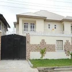
Our professional land survey services deliver accurate boundary identification and topographic mapping essential for infrastructure development and construction planning. We utilize advanced surveying equipment to provide reliable geospatial data that supports engineering design and site development requirements across various project scales and complexities.

These services are crucial for transportation projects, commercial development, and environmental planning initiatives. Our team combines technical expertise with practical field experience to support projects from initial feasibility studies through final construction verification, ensuring compliance with regulatory standards and precise project execution.
- Property boundary surveys for legal documentation and land acquisition
- Topographic mapping for engineering design and site planning
- Construction layout services for building foundations and infrastructure
- Land subdivision surveys for residential and commercial development
- Elevation certificates and flood zone determination for risk assessment
Trade Details
| Available Stock | In stock |
| Sample Availability | No |
Payment Terms
| Payment Terms |
|
Company Profile
D. Vyas & Associates, Madhya Pradesh
 Madhya Pradesh, India
Construction
Factory Details
Factory SizeBelow 1000 sqm
Annual Production Capacity0
Land Survey Services For Boundary Mapping And Topographic Surveys
Professional land survey services for precise boundary mapping and topographic surveys using advanced technology for infrastructure and development projects with expert technical support.
Min. Order Quantity: 1 units
Shipping
Shipping fee and delivery date to be negotiated. Contact supplier now for more details.
D. Vyas & Associates Madhya Pradesh, India
Construction