undefined
Similar Products


Description
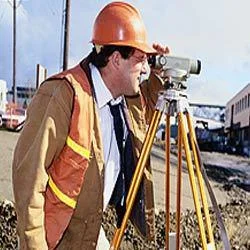
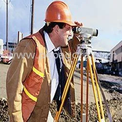
Our Professional Total Station land survey services deliver precision measurement solutions for demanding project requirements. We provide comprehensive surveying using advanced el...
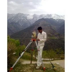
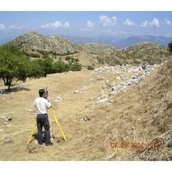
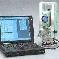
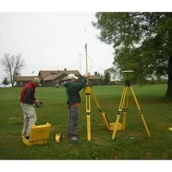
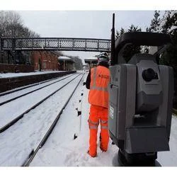
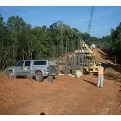
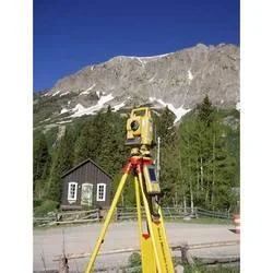
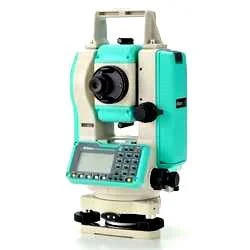
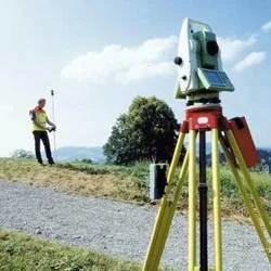
Our Professional Total Station land survey services deliver precision measurement solutions for demanding project requirements. We provide comprehensive surveying using advanced electronic instruments that integrate optical theodolite technology with electronic distance measurement capabilities. These services adhere to international quality standards, ensuring accurate data collection for slope distances, angles, and coordinates. Our approach combines technical expertise with state-of-the-art equipment to deliver reliable results for critical projects where measurement accuracy directly impacts project success, safety compliance, and operational efficiency across various applications and industries.

These services serve multiple sectors including construction, civil engineering, mining operations, and infrastructure development. Construction companies depend on our surveys for precise building layouts and foundation work, while mining operations utilize our volumetric calculations for effective resource management. Infrastructure projects benefit from our alignment surveys for roads, railways, and tunnels. Municipal authorities and development agencies use our services for land records management and urban planning initiatives. The technology also supports environmental monitoring and archaeological documentation projects that require non-invasive measurement techniques and precise spatial data collection.

Clients choose our Total Station services for their proven reliability, consistent performance, and accurate data delivery. Our solutions significantly reduce project risks by minimizing measurement errors that could lead to costly rework or compliance complications. The service flexibility enables clients to scale surveying operations according to specific project requirements without substantial investments in equipment and specialized personnel. We maintain rigorous quality control throughout all phases including data collection, processing, and reporting, ensuring clients receive actionable insights for informed decision-making and effective project management outcomes.

Key Features:
- Electronic distance measurement with millimeter-level accuracy for precise data collection
- Integrated theodolite functionality for comprehensive angle and coordinate measurements
- ISO-compliant service protocols ensuring quality and data interoperability
- Robust equipment performance across various environmental and terrain conditions
- Comprehensive data processing and reporting capabilities for project documentation

Benefits:
- Enhanced project accuracy through millimeter-level precision measurements
- Reduced operational risks by minimizing costly measurement errors and rework
- Time efficiency through streamlined surveying processes and rapid data collection
- Regulatory compliance support with standardized measurement protocols
- Cost-effective solution eliminating need for equipment investment and training
Specifications
| Additional Information | |
|---|---|
| Country of Origin | India |
| Customisable | No |
Application
Total Station land survey services provide high-precision mapping and measurement capabilities essential for modern development projects. These advanced electronic instruments combine theodolite and distance meter functions to deliver accurate data for planning, construction, and monitoring applications. The technology is particularly valuable for large-scale projects where millimeter-level precision is critical for successful execution and regulatory compliance across various industries and environments.

These services support informed decision-making in civil engineering, urban development, and resource management sectors. By providing reliable topographic data, boundary surveys, and volumetric calculations, Total Station services help optimize project timelines, reduce costly errors, and maintain compliance standards. The adaptability to both indoor and outdoor settings makes this technology indispensable for infrastructure development, land management, and construction monitoring applications requiring dependable measurement data.
- Construction site planning and building layout verification for architectural projects
- Road and highway alignment surveys for transportation infrastructure development
- Mining volume calculations and stockpile measurements for resource management
- Land boundary demarcation and cadastral surveys for legal and property purposes
- Monitoring structural deformations in dams, bridges, and tunnel projects
Trade Details
| Available Stock | In stock |
| Sample Availability | No |
Payment Terms
| Payment Terms |
|
Company Profile
A One Associates, Punjab
 Punjab, India
Factory Details
Factory SizeBelow 1000 sqm
Annual Production Capacity0
Professional Total Station Land Survey Services For Construction And Mining
Professional Total Station land survey services deliver precise measurements for construction, mining, and infrastructure projects. Our ISO-compliant solutions ensure accuracy and reliability for demanding clients worldwide.
Min. Order Quantity: 1 units
Shipping
Shipping fee and delivery date to be negotiated. Contact supplier now for more details.
A One Associates Punjab, India