undefined

Similar Products


Description
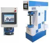
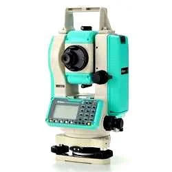
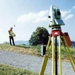
Professional surveying instruments are advanced measurement tools engineered for exceptional accuracy in demanding fieldwork. These precision devices, including total stations, GPS...
Professional surveying instruments are advanced measurement tools engineered for exceptional accuracy in demanding fieldwork. These precision devices, including total stations, GPS systems, and digital levels, incorporate reliable data collection capabilities for a wide range of surveying applications. They undergo rigorous quality testing to ensure consistent performance across challenging environments, providing the measurement reliability that surveyors, engineers, and construction professionals depend on for critical project decisions and accurate spatial data acquisition. Their robust design and advanced technology make them a cornerstone for precise land measurement and mapping.

These instruments play an essential role across key sectors such as civil engineering, construction, mining, agriculture, and urban development. Construction teams utilize them for accurate building placement, foundation work, and structural alignment. Mining operations rely on them for precise volume calculations, excavation monitoring, and pit surveying. Civil engineers apply these tools to infrastructure projects including roads, bridges, tunnels, and utility installations, while agricultural managers use them for land development, irrigation system planning, and terrain analysis, ensuring efficient resource management.

The business value of these surveying instruments lies in their proven reliability, pinpoint accuracy, and operational efficiency. They significantly reduce measurement errors, minimize costly project rework, and improve overall workflow productivity, leading to substantial cost savings and enhanced project profitability. Their durable construction ensures long-term performance in harsh field conditions, from extreme temperatures to dusty or wet environments. Intuitive operation reduces training time and improves user adoption, while the consistent accuracy supports confident decision-making and precise project execution across diverse industry applications.

Key Features:
- High-precision measurement capabilities with millimeter-level accuracy
- Rugged construction designed for demanding field conditions and durability
- Advanced GPS and laser technology integration for comprehensive data collection
- User-friendly interfaces with intuitive operation and clear displays
- Quality-tested components ensuring consistent and reliable performance

Benefits:
- Reduced measurement errors and minimized project rework, saving time and resources
- Improved operational efficiency and enhanced workflow productivity on-site
- Cost savings through accurate planning, execution, and reduced material waste
- Durable performance in challenging environmental conditions, ensuring longevity
- Enhanced project profitability and client satisfaction through reliable data collection
Specifications
| Additional Information | |
|---|---|
| Country of Origin | India |
| Customisable | No |
Application
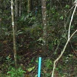
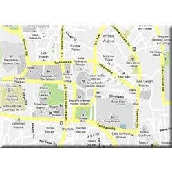
Professional surveying instruments deliver essential precision for land measurement, boundary determination, and spatial data collection across diverse environments. These tools enable accurate mapping and topographical analysis, supporting critical decision-making in development and construction workflows with reliable data accuracy and consistent field performance for projects of all scales.

These advanced instruments serve multiple industries including civil engineering, mining, urban planning, and infrastructure development. Their applications extend to construction layout, environmental assessment, and agricultural land management, making them indispensable for projects requiring precise spatial information during both planning and execution phases under various operational conditions.
- Construction site preparation and building layout measurements
- Road and highway alignment and gradient calculations
- Land subdivision and property boundary demarcation
- Topographic mapping for urban planning and development
- Mining operations volume calculations and pit surveying
Trade Details
| Available Stock | In stock |
| Sample Availability | No |
Payment Terms
| Payment Terms |
|
Company Profile
Hi-Tech India, Tamil Nadu
 Tamil Nadu, India
ManufacturerImporter / Exporter
Factory Details
Factory SizeBelow 1000 sqm
Annual Production Capacity0
Professional Surveying Instruments For Accurate Land Measurement And Mapping
Professional surveying instruments provide precise land measurement and mapping for construction and engineering. Trusted for reliability and advanced features in demanding field conditions.
Min. Order Quantity: 1 units
Shipping
Shipping fee and delivery date to be negotiated. Contact supplier now for more details.
Hi-Tech India Tamil Nadu, India
Manufacturer