undefined

Similar Products


Description
Our professional rural road survey services provide comprehensive terrain mapping and precise route planning solutions specifically engineered for remote and challenging landscapes...
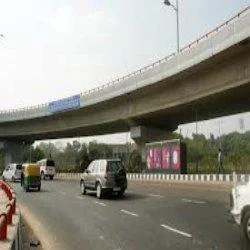
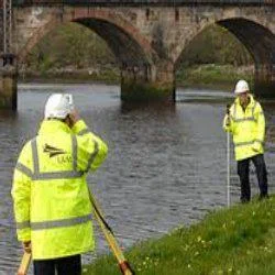
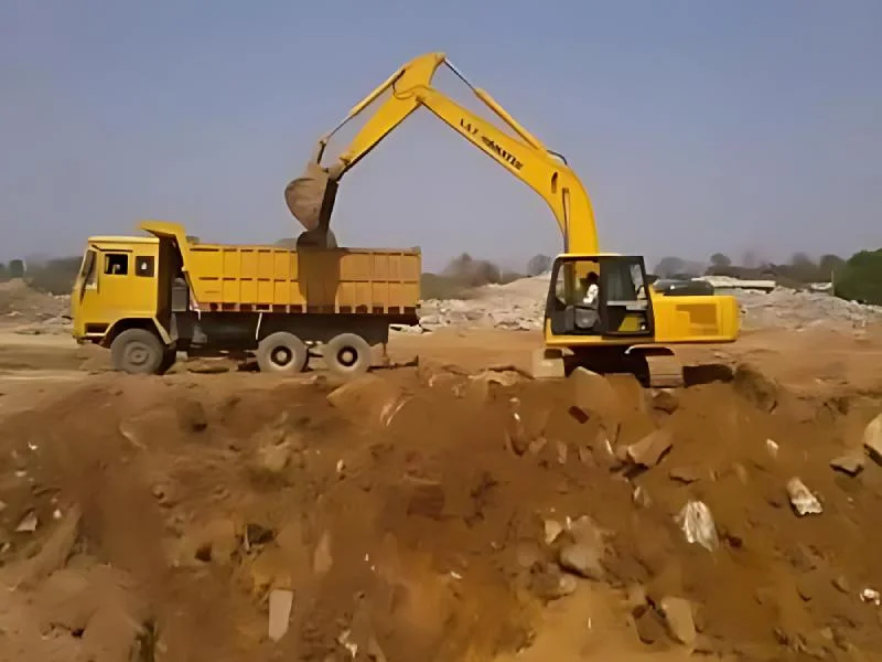
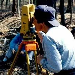
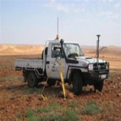
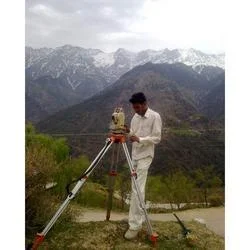
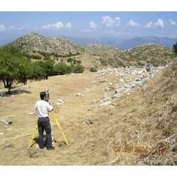
Our professional rural road survey services provide comprehensive terrain mapping and precise route planning solutions specifically engineered for remote and challenging landscapes. Utilizing advanced surveying technology including GPS, drones, and sophisticated software, we deliver accurate data collection encompassing topographical surveys, alignment studies, and soil analysis. Our end-to-end service covers the complete survey lifecycle from initial reconnaissance to detailed project reports, ensuring complete visibility into terrain characteristics, construction feasibility, and potential obstacles. We maintain rigorous quality standards while adapting methodologies to diverse project requirements across varying geographical regions, delivering reliable data that forms the critical foundation for successful infrastructure development.

These survey services are extensively utilized by government public works departments, infrastructure development corporations, and private construction firms engaged in rural connectivity initiatives. Municipal authorities and transportation agencies rely on our expertise for implementing rural road schemes and connectivity programs. Engineering consultancies utilize our precise data for designing cost-effective, efficient road networks, while environmental organizations partner with us for sustainable infrastructure planning that minimizes ecological impact. Our services also support agricultural development authorities in creating improved farm connectivity and logistics companies planning distribution networks in underserved rural areas, ensuring economic growth through better transportation access.

We deliver exceptional value through reliable, accurate data that significantly reduces project risks and prevents costly overruns. Our detailed surveys help clients avoid unexpected terrain challenges, ensure full regulatory compliance throughout the development process, and optimize construction planning. The commitment to precision translates into long-term road durability, reduced maintenance costs, and excellent return on investment for infrastructure developers. By providing customized solutions tailored to specific budget constraints and project timelines, we enable efficient resource allocation and timely project completion, building trust through consistent delivery of high-quality surveying services that stand up to the toughest rural conditions.

Key Features:
- Advanced GPS and drone technology for precise, efficient terrain mapping
- Comprehensive topographical analysis and detailed soil condition assessment
- Customizable survey packages scaled to different project requirements
- Detailed alignment planning with route optimization recommendations
- Complete regulatory compliance documentation and approval support

Benefits:
- Reduces project risks and prevents unexpected cost overruns through accurate data
- Ensures long-term road durability and minimizes future maintenance expenses
- Provides reliable foundation for regulatory compliance and approval processes
- Enables optimal route planning that considers environmental and construction factors
- Delivers excellent return on investment through efficient resource allocation
Specifications
| Additional Information | |
|---|---|
| Country of Origin | India |
| Customisable | No |
Application
Our rural road survey services provide essential terrain analysis and precise route mapping for developing durable transportation networks in remote regions. We deliver accurate topographical data and alignment planning that meets strict government standards, ensuring optimal road placement while considering environmental factors and construction viability. These detailed surveys support every phase from initial planning to final execution, providing comprehensive reports for informed decision-making across diverse geographical challenges and project specifications.

These services are crucial for infrastructure projects requiring meticulous land assessment and regulatory adherence. We help identify the most feasible routes, analyze soil conditions, and assess terrain characteristics to minimize construction risks. Our team adapts to various landscapes, delivering consistent, reliable data that forms the foundation for successful, long-lasting rural road development and connectivity improvements.
- Government rural road development programs and national connectivity schemes
- Construction firms planning new road infrastructure in challenging terrains
- Environmental agencies conducting assessments for sustainable road projects
- Disaster management teams for emergency access route planning and mapping
- Agricultural boards and cooperatives improving farm-to-market road access
Trade Details
| Available Stock | In stock |
| Sample Availability | No |
Payment Terms
| Payment Terms |
|
Company Profile
Creative Engineering Services, Uttar Pradesh
 Uttar Pradesh, India
Factory Details
Factory SizeBelow 1000 sqm
Annual Production Capacity0
Rural Road Survey Services For Accurate Terrain Mapping And Route Planning
Professional rural road survey services deliver accurate terrain mapping and route planning using advanced technology. Trusted by government agencies and construction firms for reliable infrastructure development solutions.
Min. Order Quantity: 1 units
Shipping
Shipping fee and delivery date to be negotiated. Contact supplier now for more details.
Creative Engineering Services Uttar Pradesh, India