undefined
Similar Products


Description
Our professional route survey services provide precise geospatial data essential for infrastructure design and construction projects. We specialize in comprehensive surveying for h...
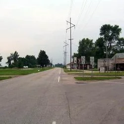
Our professional route survey services provide precise geospatial data essential for infrastructure design and construction projects. We specialize in comprehensive surveying for highways, pipelines, canals, and railroads, ensuring accuracy from initial planning through final execution. Our experienced team utilizes advanced methodologies and cutting-edge technology to support every phase including reconnaissance, works design, right-of-way acquisition, and construction monitoring. We deliver reliable data that forms the foundation for successful infrastructure development, with a commitment to accuracy and precision that makes us the trusted choice for clients seeking professional surveying services at competitive industry prices.

Route survey services are critical across multiple infrastructure industries including transportation, energy, water management, and public works. Highway construction projects rely on our precise alignment and grading data for optimal road design and safety compliance. Pipeline companies depend on our corridor mapping expertise for efficient energy infrastructure installation and maintenance. Water management authorities utilize our canal alignment surveys for irrigation systems and flood control projects. Railroad developers trust our track design surveys for transportation network expansion and maintenance. Municipalities and government agencies engage our services for right-of-way acquisition and regulatory compliance support across various public infrastructure initiatives.

Our route survey services deliver significant business value by reducing project risks through precise data collection and analysis. We ensure regulatory compliance and safety standards are met throughout the project lifecycle, protecting your investment and reputation. Our accurate surveying supports cost-effective construction planning by identifying potential challenges early and enabling proactive solutions. We enhance project timeline accuracy through efficient data delivery and comprehensive reporting that keeps your project on schedule. The reliability of our surveying methodology provides a solid foundation for engineering designs, ensuring long-term infrastructure durability and performance while minimizing future maintenance costs and operational disruptions.

Key Features:
- Accurate terrain mapping and alignment data collection using advanced technology
- Comprehensive four-phase methodology covering reconnaissance to construction monitoring
- Detailed reporting and documentation for construction planning and regulatory compliance
- Experienced professional team with expertise in diverse infrastructure project types
- Precise elevation assessment and right-of-way mapping for project planning

Benefits:
- Reduced project risks through early identification of potential challenges and obstacles
- Enhanced safety compliance and regulatory approval through accurate data documentation
- Cost-effective construction planning with optimized route selection and design
- Improved project timeline accuracy with efficient data delivery and reporting
- Long-term infrastructure durability through precise engineering foundation data
Specifications
| Additional Information | |
|---|---|
| Country of Origin | India |
| Customisable | No |
Application
Our professional route survey services deliver critical geospatial data essential for infrastructure development projects across multiple sectors. We provide comprehensive surveying solutions that ensure accurate alignment, elevation assessment, and terrain mapping for highways, pipelines, canals, and railroads. Our methodology covers every project phase from initial planning through final construction, supporting optimal route selection and engineering design with precision and reliability.

Route surveying forms the foundation for successful infrastructure projects by identifying optimal paths and potential challenges early in the planning process. Our services support works design, regulatory compliance, and right-of-way acquisition while maintaining cost efficiency and project timelines. The accurate data we provide enables engineers and project managers to make informed decisions that enhance safety, reduce construction risks, and ensure long-term infrastructure performance across various applications and industries.
- Highway construction route planning for optimal alignment and grading design
- Pipeline corridor mapping and installation planning for energy infrastructure
- Canal construction alignment surveys for water management and irrigation systems
- Railroad track design and development surveys for transportation networks
- Infrastructure right-of-way acquisition support for land use planning
Trade Details
| Available Stock | In stock |
| Sample Availability | No |
Payment Terms
| Payment Terms |
|
Company Profile
Dhyani Consultants Inc., New Delhi
 New Delhi, India
Electronics & Electrical•Distributor / WholesalerRetailerImporter / Exporter
Factory Details
Factory SizeBelow 1000 sqm
Annual Production Capacity0
Professional Route Survey Services For Highway Pipeline Canal Railroad Construction
Professional route survey services for highway, pipeline, canal, and railroad construction projects. Our precise surveying delivers accurate alignment data and terrain assessment using advanced technology for reliable infrastructure planning and development.
Min. Order Quantity: 1 units
Shipping
Shipping fee and delivery date to be negotiated. Contact supplier now for more details.
Dhyani Consultants Inc. New Delhi, India
Electronics & ElectricalDistributor / Wholesaler