undefined
Similar Products


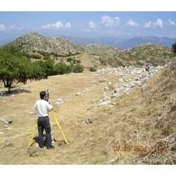

Description
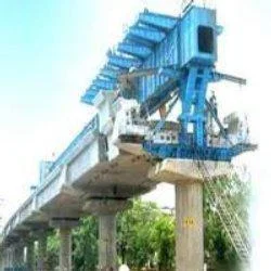
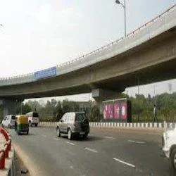
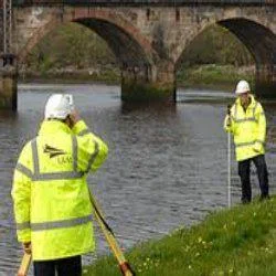
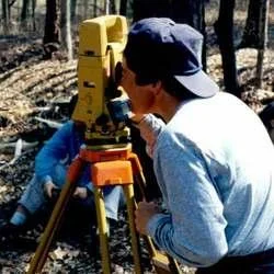
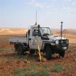
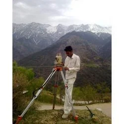
Our professional river survey services deliver comprehensive hydrographic data collection and analysis for engineering, environmental, and infrastructure projects. Utilizing advanc...
Our professional river survey services deliver comprehensive hydrographic data collection and analysis for engineering, environmental, and infrastructure projects. Utilizing advanced technology including multibeam echo sounders, GPS positioning systems, and modern data processing software, we provide accurate riverbed mapping, cross-section profiling, and water flow measurements. Our team of certified hydrographic surveyors follows international standards to ensure data reliability and precision, making our services ideal for projects requiring detailed understanding of river morphology, sediment transport patterns, and hydraulic characteristics. We maintain rigorous quality control throughout the surveying process to deliver results that meet the highest technical standards.

These services are extensively utilized across multiple industries including civil engineering for bridge and dam construction, environmental consulting for habitat assessment and restoration projects, government agencies for flood management and navigation maintenance, and resource companies for pipeline and cable routing. Municipal water departments rely on our surveys for watershed management and floodplain mapping, while research institutions utilize our data for hydrological studies and climate change impact assessment. The construction industry depends on our accurate riverbed profiles for foundation design and erosion protection planning, ensuring project safety and regulatory compliance across various applications.

Clients choose our river survey services for their proven reliability, exceptional accuracy, and professional reporting that meets all regulatory requirements and engineering standards. Our commitment to timely delivery and responsive client communication ensures project timelines are maintained while data quality remains uncompromised. The value extends beyond basic data collection to include expert interpretation, risk assessment, and practical recommendations that support informed decision-making. Our extensive track record of successful projects across diverse river environments demonstrates our capability to handle challenging conditions and deliver results that withstand technical scrutiny and regulatory review.

Key Features:
- Advanced multibeam sonar and GPS technology for precise data collection
- Certified hydrographic surveyors with extensive river surveying experience
- Customized survey methodologies tailored to specific project requirements
- Comprehensive data processing and quality control procedures
- Detailed reporting formats including maps, cross-sections, and volumetric calculations

Benefits:
- Accurate hydrographic data supporting informed infrastructure decisions
- Reliable riverbed mapping for engineering design and safety compliance
- Comprehensive environmental monitoring for regulatory requirements
- Efficient project planning through detailed cross-section profiling
- Long-term cost savings through precise sediment transport analysis
Specifications
| Additional Information | |
|---|---|
| Country of Origin | India |
| Customisable | No |
Application
Our river survey services deliver essential hydrographic data for infrastructure development and environmental management. Using advanced multibeam sonar and GPS technology, we provide precise riverbed mapping, water flow analysis, and sediment transport measurements that support critical decision-making in water resource projects. These comprehensive surveys are vital for flood risk assessment, navigation maintenance, and ecosystem monitoring across various river environments and conditions.

These surveying solutions serve multiple sectors including civil engineering, environmental consulting, government water departments, and construction companies. The accurate data we generate supports bridge and dam construction, pipeline routing, dredging operations, and watershed management. Our tailored survey approaches ensure each project receives appropriate methodology whether for shallow water mapping, rapid assessments, or long-term monitoring programs requiring consistent data protocols and standardized reporting.
- Flood risk assessment and mitigation planning for urban and rural river systems
- Navigation channel mapping and maintenance dredging for ports and waterways
- Environmental impact assessments and aquatic habitat mapping for conservation
- Infrastructure development support including bridge foundations and pipeline crossings
- Water resource management and hydrological modeling for government and research
Trade Details
| Available Stock | In stock |
| Sample Availability | No |
Payment Terms
| Payment Terms |
|
Company Profile
Creative Engineering Services, Uttar Pradesh
 Uttar Pradesh, India
Factory Details
Factory SizeBelow 1000 sqm
Annual Production Capacity0
Professional River Survey Services For Hydrographic Mapping And Environmental Monitoring
Professional river survey services provide accurate hydrographic mapping and bathymetric analysis for environmental monitoring and infrastructure planning. Trusted by engineering firms and government agencies for reliable data collection and detailed reporting.
Min. Order Quantity: 1 units
Shipping
Shipping fee and delivery date to be negotiated. Contact supplier now for more details.
Creative Engineering Services Uttar Pradesh, India