undefined
Similar Products


Description
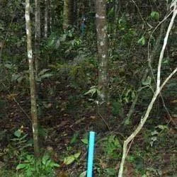
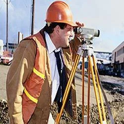
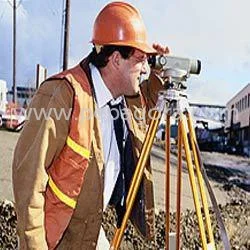
Our professional railway survey services deliver comprehensive geospatial data collection and analysis specifically engineered for rail infrastructure. We employ advanced technolog...
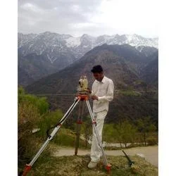
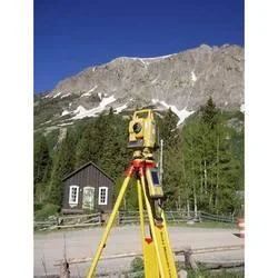
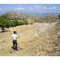
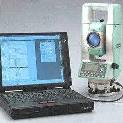
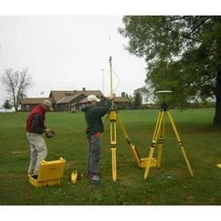
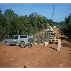
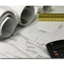
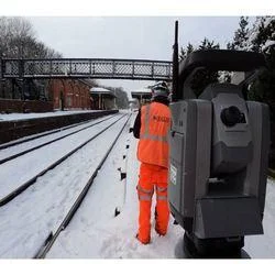
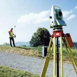
Our professional railway survey services deliver comprehensive geospatial data collection and analysis specifically engineered for rail infrastructure. We employ advanced technologies including high-precision GPS, terrestrial and mobile LiDAR, and drone-based photogrammetry to capture accurate measurements for track alignment, elevation, superelevation, and geometry. Our team of specialized surveyors understands the unique requirements of railway projects, ensuring data collection adheres to stringent international standards and regulatory frameworks. We support the entire project lifecycle—from initial feasibility studies and design through construction, commissioning, and into long-term maintenance—providing the reliable, precise data necessary for successful railway infrastructure development and safe operations.

These survey services are indispensable across the rail sector, including national passenger networks, urban metro and light rail systems, heavy-haul freight corridors, and industrial sidings. Government transportation authorities and rail operators utilize our data for network expansion, modernization programs, and asset management. Engineering and construction firms rely on our precise topographic and as-built surveys for new track laying, station development, yard layouts, and route optimization. Maintenance and renewal contractors depend on our detailed inspection surveys to proactively identify issues like track wear, settlement, gauge variation, and potential geometry faults, enabling planned interventions that enhance safety and reliability.

The business value delivered by our railway survey services is substantial, centered on risk reduction, cost efficiency, and operational confidence. By providing accurate, timely geospatial intelligence, we help clients avoid expensive rework due to construction errors, minimize service disruptions during maintenance windows, and support data-driven decisions that extend asset lifespan. Our reliability is built on rigorous quality assurance protocols, highly experienced field and office personnel, and investment in state-of-the-art equipment that guarantees consistent, verifiable results across diverse projects and environments. We focus on delivering suitability and clarity, transforming complex spatial data into clear, actionable insights for project stakeholders.

Key Features:
- Utilization of advanced GPS, LiDAR, and drone technology for high-accuracy rail and infrastructure measurements.
- Comprehensive track geometry analysis covering alignment, level, gauge, twist, and curvature parameters.
- Detailed reporting with clear data visualizations, including plans, profiles, cross-sections, and digital terrain models.
- Services provided by experienced surveyors with specialized knowledge of railway standards and practices.
- A focus on delivering reliable, precise data tailored to support specific project phases and requirements.

Benefits:
- Reduces project risk and potential for costly errors through accurate, upfront geospatial data.
- Supports compliance with safety standards and regulatory requirements for rail infrastructure.
- Enables optimized maintenance planning by identifying and quantifying track and asset conditions.
- Provides a clear factual basis for design, construction, and investment decisions.
- Enhances operational efficiency and asset longevity through precise monitoring and documentation.
Specifications
| Additional Information | |
|---|---|
| Country of Origin | India |
| Customisable | No |
Application
Our railway survey services provide essential data for maintaining safe, efficient rail operations. We use advanced technologies to capture precise measurements of track geometry, alignment, and surrounding infrastructure. This accurate information forms the foundation for compliance with safety regulations and helps prevent operational disruptions before they occur.

These services support both new construction initiatives and the ongoing upkeep of existing networks. We collaborate with project managers and engineers to deliver comprehensive survey solutions that inform critical decisions. Our data-driven methodology aids in optimizing route planning, mitigating construction risks, and extending the service life of valuable rail assets through meticulous monitoring and analysis.
- Conducting track alignment and geometry surveys for the construction of new railway lines and extensions.
- Performing periodic inspection and condition monitoring of existing rail tracks and infrastructure for maintenance scheduling.
- Executing land and corridor surveying for railway development, expansion, and right-of-way mapping projects.
- Providing structural assessment surveys for bridges, tunnels, and culverts to ensure safety and integrity.
- Supporting installation and upgrade projects for railway electrification, signaling, and communication systems.
Trade Details
| Available Stock | In stock |
| Sample Availability | No |
Payment Terms
| Payment Terms |
|
Company Profile
A One Associates, Punjab
 Punjab, India
Factory Details
Factory SizeBelow 1000 sqm
Annual Production Capacity0
Railway Survey Services For Track Alignment And Infrastructure Mapping
Precision railway survey services for track alignment and infrastructure mapping deliver accurate geospatial data for rail construction, maintenance, and planning projects with reliable, professional support.
Min. Order Quantity: 1 units
Shipping
Shipping fee and delivery date to be negotiated. Contact supplier now for more details.
A One Associates Punjab, India