undefined

Similar Products


Description
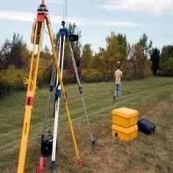
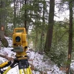
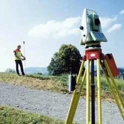
Our professional land survey services deliver comprehensive land assessment solutions using advanced technologies including GPS systems, total stations, and drone surveying. We pro...
Our professional land survey services deliver comprehensive land assessment solutions using advanced technologies including GPS systems, total stations, and drone surveying. We provide accurate topographic, boundary, and construction surveys through our team of certified surveyors with extensive experience across diverse terrains and project types. Our approach ensures reliable data collection and detailed reporting that meets strict industry standards and client specifications, prioritizing accuracy, efficiency, and regulatory compliance in every engagement to become a trusted partner for businesses depending on precise land information.

These surveying services serve critical roles across construction, real estate development, infrastructure projects, mining operations, and government sectors. Construction companies rely on our surveys for precise site planning and foundation work, while real estate developers utilize our boundary surveys for property transactions and development planning. Infrastructure projects including roads, bridges, and utilities depend on our topographic surveys for proper design and implementation. Mining operations employ our services for terrain mapping and volume calculations, while government agencies require our surveys for urban planning initiatives and land records management.

Clients choose our land survey services for their proven reliability, accuracy, and direct impact on project success and cost management. Our precise data helps prevent expensive errors, ensures full regulatory compliance, and supports informed decision-making throughout project lifecycles. The investment in professional surveying delivers significant returns through effective risk mitigation, optimized resource allocation, and strict project timeline adherence. Our commitment to quality assurance and timely delivery establishes us as a valuable partner for businesses that cannot tolerate surveying inaccuracies or operational delays.

Key Features:
- Advanced GPS and drone technology for precise measurements
- Certified professional surveyors with extensive industry expertise
- Comprehensive topographic and boundary surveying capabilities
- Tailored survey solutions for specific project requirements
- Detailed digital and hardcopy reporting with accurate data documentation

Benefits:
- Prevents costly errors through accurate land data collection
- Ensures regulatory compliance and reduces project risks
- Supports informed decision-making throughout project lifecycles
- Optimizes resource allocation and project timeline adherence
- Delivers reliable data for successful project execution
Specifications
| Additional Information | |
|---|---|
| Country of Origin | India |
| Customisable | No |
Application
Our professional land survey services provide essential data for site planning and development across multiple sectors. We deliver precise topographic maps, boundary determinations, and elevation data that form the foundation for successful project execution in construction, infrastructure, and development projects. This critical information helps minimize risks and ensures regulatory compliance throughout project lifecycles.

These surveying solutions support architects, engineers, and developers in making informed decisions based on reliable land data. From urban development to industrial projects, our services accommodate various scales with tailored approaches that meet specific industry requirements and tight timelines while maintaining accuracy and compliance standards.
- Construction site preparation and foundation planning
- Property boundary demarcation and legal documentation
- Road and highway development project surveys
- Urban planning and municipal infrastructure development
- Mining and quarry operations planning and volume calculations
Trade Details
| Available Stock | In stock |
| Sample Availability | No |
Payment Terms
| Payment Terms |
|
Company Profile
Best Surveyors & Valuers Private Limited, West Bengal
 West Bengal, India
Services & Support
Factory Details
Factory SizeBelow 1000 sqm
Annual Production Capacity0
Professional Land Survey Services For Clients
Professional land survey services deliver precise topographic, boundary, and construction surveys using advanced GPS and drone technology. Trusted for accurate data and reliable project support across multiple industries.
Min. Order Quantity: 1 units
Shipping
Shipping fee and delivery date to be negotiated. Contact supplier now for more details.
Best Surveyors & Valuers Private Limited West Bengal, India
Services & Support