undefined
Similar Products


Description
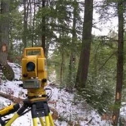
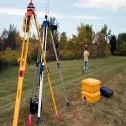
Our Professional Land Survey Services provide accurate land measurement and mapping solutions using advanced technology like GPS and total stations. Our experienced team specialize...
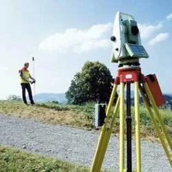
Our Professional Land Survey Services provide accurate land measurement and mapping solutions using advanced technology like GPS and total stations. Our experienced team specializes in topographic, boundary, and construction surveys, delivering precise data collection and analysis that forms the critical foundation for your projects. We ensure every measurement meets the highest standards of accuracy and reliability, empowering businesses to make informed decisions, reduce risks, and ensure project success from initial planning through to completion.

These survey services are extensively utilized across construction, real estate development, civil infrastructure, mining, and agricultural sectors. Construction firms rely on our surveys for site planning and foundation work, while developers use our boundary surveys for property transactions. Government agencies employ our services for urban planning and public works, mining operations depend on our measurements for exploration, and the agricultural sector benefits for land division and irrigation planning, ensuring every project begins with verified, trustworthy data.

We deliver significant business value through reliable, accurate surveys that prevent costly errors, disputes, and delays. Our services help avoid construction mistakes, property boundary conflicts, and regulatory compliance issues. The reliability of our data ensures projects proceed smoothly, with all stakeholders aligned. Our commitment to precision and detailed reporting provides a clear audit trail, supporting legal requirements, financial planning, and long-term asset management for optimal return on investment.

Key Features:
- Utilization of advanced surveying technology including GPS, total stations, and laser scanning
- Execution by experienced, certified professional surveyors with deep industry expertise
- Comprehensive service range covering topographic, boundary, and construction surveys
- Delivery of detailed, CAD-ready mapping and comprehensive data reporting
- Adherence to strict quality protocols ensuring measurement accuracy and data integrity

Benefits:
- Prevents costly project errors, rework, and legal disputes through precise data
- Ensures regulatory and zoning compliance for seamless project approvals
- Provides a reliable foundation for informed planning and financial decision-making
- Enhances project efficiency and timelines with accurate, actionable site information
- Delivers long-term value by creating a verified data record for asset management
Specifications
| Additional Information | |
|---|---|
| Country of Origin | India |
| Customisable | No |
Application
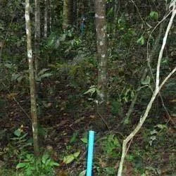
Our professional land survey services deliver the precise measurements and detailed mapping essential for successful project planning and execution. We provide the critical data foundation for construction, infrastructure, and development projects, ensuring all stakeholders have accurate, reliable information from the very start to mitigate risks and prevent costly errors.

These services are vital for industries requiring exact land measurements and legal boundary definitions. From urban development to rural land management, our surveys help prevent disputes, ensure regulatory compliance, and support informed decision-making for project feasibility, resource management, and long-term asset planning.
- Construction site preparation, foundation planning, and as-built verification
- Property boundary demarcation, legal documentation, and title dispute resolution
- Road, highway, bridge, and utility infrastructure development projects
- Topographic and contour mapping for architectural, engineering, and environmental designs
- Land subdivision, zoning compliance verification, and cadastral mapping
Trade Details
| Available Stock | In stock |
| Sample Availability | No |
Payment Terms
| Payment Terms |
|
Company Profile
Best Surveyors & Valuers Private Limited, West Bengal
 West Bengal, India
Services & Support
Factory Details
Factory SizeBelow 1000 sqm
Annual Production Capacity0
Professional Land Survey Services For Clients
Professional Land Survey Services deliver precise topographic, boundary, and construction surveys using advanced technology. Trusted for accuracy and reliability across industries, these services provide the critical data foundation for successful project planning and execution.
Min. Order Quantity: 1 units
Shipping
Shipping fee and delivery date to be negotiated. Contact supplier now for more details.
Best Surveyors & Valuers Private Limited West Bengal, India
Services & Support