undefined
Similar Products


Description
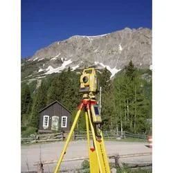
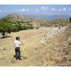
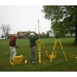
Our professional land survey services deliver comprehensive topographical and contour mapping solutions for businesses requiring precise terrain data. We specialize in detailed sur...
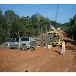
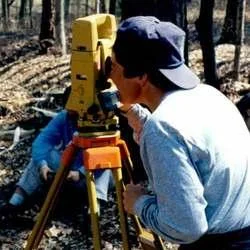
Our professional land survey services deliver comprehensive topographical and contour mapping solutions for businesses requiring precise terrain data. We specialize in detailed surveys that capture elevation points, natural features, and man-made structures with exceptional accuracy. Our team utilizes advanced surveying equipment and methodologies to provide reliable data that forms the foundation of successful construction and development projects. We understand that accurate land information is crucial for project planning, cost estimation, and regulatory compliance, which is why we maintain strict quality standards throughout our surveying process.

Various industries benefit from our land survey expertise, particularly construction companies, civil engineering firms, urban planning departments, and real estate developers. The construction sector relies on our contour surveys for site preparation and foundation design, while municipal authorities use our data for infrastructure planning and public works projects. Environmental consultants engage our services for terrain analysis and ecological assessments. We also serve mining operations, agricultural planners, and telecommunications companies requiring precise land data for their operational needs and expansion projects.

Our land survey services deliver significant business value through reliable data that reduces project risks and prevents costly errors. The accuracy of our surveys ensures proper planning and execution of development projects, saving time and resources while maintaining compliance with regulatory standards. We differentiate ourselves through our commitment to quality, customized approach to each project, and reliable deliverables that clients can trust for critical decision-making. Our surveys provide the confidence needed to move forward with investments and development plans, knowing the terrain data is thoroughly documented and precise.

Key Features:
- Comprehensive topographical mapping with detailed contour lines
- Precise elevation measurements and spot level documentation
- Advanced surveying equipment and technology implementation
- Customized survey solutions tailored to specific project requirements
- Detailed documentation of natural and man-made terrain features

Benefits:
- Reduces project risks and prevents costly construction errors
- Ensures regulatory compliance and development permit approval
- Provides accurate data for informed project planning and decision-making
- Saves time and resources through precise terrain documentation
- Supports successful project execution with reliable site analysis
Specifications
| Additional Information | |
|---|---|
| Country of Origin | India |
| Customisable | No |
Application
Our professional land survey services provide detailed topographical mapping and contour surveys essential for pre-construction planning and infrastructure development. We deliver precise measurements of terrain features, elevations, and natural land formations, ensuring accurate data for engineering and architectural projects. These surveys are critical for identifying optimal site conditions, managing earthwork calculations, and complying with regulatory requirements for development permits.

Industries relying on our expertise include civil engineering, urban planning, real estate development, and environmental consulting. Our services support projects requiring precise land data such as road construction, drainage system design, utility installation, and landscape architecture. We cater to clients including construction firms, government agencies, and engineering consultancies needing reliable survey data for informed decision-making and project feasibility assessments.
- Pre-construction site analysis for building foundations and structural planning
- Infrastructure development including roads, bridges, and transportation networks
- Utility mapping for water supply lines, sewer systems, and stormwater drainage
- Land development and subdivision planning for real estate projects
- Environmental assessment and terrain analysis for ecological projects
Trade Details
| Available Stock | In stock |
| Sample Availability | No |
Payment Terms
| Payment Terms |
|
Company Profile
A One Associates, Punjab
 Punjab, India
Factory Details
Factory SizeBelow 1000 sqm
Annual Production Capacity0
Professional Land Survey Services For Accurate Topographical And Contour Mapping
Professional land survey services deliver accurate topographical and contour mapping for construction, infrastructure, and development projects requiring precise terrain data and reliable site analysis.
Min. Order Quantity: 1 units
Shipping
Shipping fee and delivery date to be negotiated. Contact supplier now for more details.
A One Associates Punjab, India