undefined
Similar Products


Description
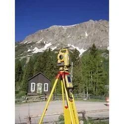
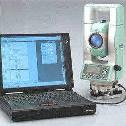
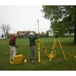
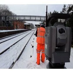
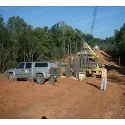
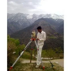
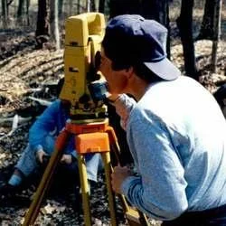
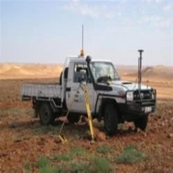
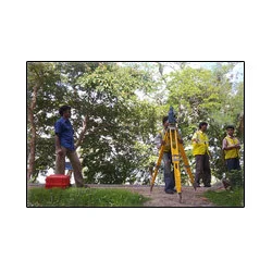
Our hydrographic survey services provide comprehensive underwater mapping and data collection for marine construction and industrial projects. Using advanced multibeam sonar, singl...
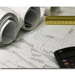
Our hydrographic survey services provide comprehensive underwater mapping and data collection for marine construction and industrial projects. Using advanced multibeam sonar, single-beam echo sounders, and high-precision GPS positioning systems, we deliver accurate depth measurements, seabed profiling, and underwater feature detection. Our team of certified hydrographers follows international standards including IHO S-44 specifications to ensure data accuracy and reliability for critical decision-making in marine environments. We specialize in both shallow water and deep water surveys, adapting our equipment and methodologies to meet specific project requirements and environmental conditions while maintaining consistent data quality.

These services are essential for multiple industries including maritime construction, offshore energy development, port management, and infrastructure planning. Construction companies utilize our surveys for bridge foundation planning, underwater pipeline installation, and dock construction projects requiring precise underwater topography. Offshore energy companies rely on our data for wind turbine placement optimization, oil platform positioning accuracy, and submarine cable routing safety. Port authorities use our services for dredging volume calculations, navigation safety assessments, and berth construction planning while environmental consultants engage our surveys for habitat mapping, sediment analysis, and coastal erosion monitoring projects.

Our hydrographic survey services deliver significant business value through risk reduction, cost savings, and regulatory compliance assurance. By providing accurate underwater data, we help clients avoid costly construction errors, optimize dredging operations, and ensure safe navigation in challenging marine environments. Our reliable surveys support informed decision-making, reduce project uncertainties, and enhance operational safety through comprehensive data validation processes. We deliver detailed reports including charts, digital terrain models, and volume calculations that meet international standards and client specifications while maintaining consistent quality across all project phases.

Key Features:
- Multibeam and single-beam sonar systems for comprehensive seabed mapping
- High-precision GPS and RTK positioning for accurate data georeferencing
- IHO-compliant survey methodologies meeting international standards
- Advanced data processing software for detailed analysis and reporting
- Certified hydrographers following rigorous quality assurance protocols

Benefits:
- Reduced project risks through accurate underwater data collection
- Cost savings by optimizing construction and dredging operations
- Regulatory compliance with international maritime standards
- Enhanced safety for navigation and marine operations
- Informed decision-making with comprehensive reporting and analysis
Specifications
| Additional Information | |
|---|---|
| Country of Origin | India |
| Customisable | No |
Application
Our hydrographic survey services provide essential underwater data collection for marine construction planning and operational safety. Using advanced sonar technology and precise GPS positioning, we deliver comprehensive seabed mapping, depth measurements, and underwater feature detection across various aquatic environments. These services ensure compliance with international standards while supporting engineering projects in challenging marine conditions.

Industrial and construction sectors depend on hydrographic surveys for pre-construction site investigations, pipeline route planning, and dredging operations. Port authorities utilize these services for maintenance dredging, berth construction, and navigation channel mapping. Offshore energy companies rely on accurate hydrographic data for wind farm installations, oil platform placements, and submarine cable routing projects in marine environments.
- Port and harbor construction with maintenance dredging operations
- Offshore wind farm site surveys and cable route mapping
- Pipeline and submarine cable installation route surveys
- Navigation channel mapping and underwater obstacle detection
- Coastal infrastructure development and erosion monitoring
Trade Details
| Available Stock | In stock |
| Sample Availability | No |
Payment Terms
| Payment Terms |
|
Company Profile
A One Associates, Punjab
 Punjab, India
Factory Details
Factory SizeBelow 1000 sqm
Annual Production Capacity0
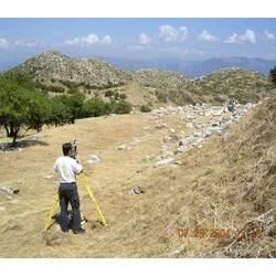
Hydrographic Survey Services For Construction And Industrial Projects
Professional hydrographic survey services deliver accurate underwater mapping, depth measurement, and seabed profiling for construction and industrial marine projects. Trusted for ports, offshore energy, and infrastructure development with reliable data collection.
Min. Order Quantity: 1 units
Shipping
Shipping fee and delivery date to be negotiated. Contact supplier now for more details.
A One Associates Punjab, India