undefined
Similar Products


Description
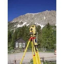
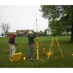
Our professional GIS and CAD survey services provide comprehensive geospatial solutions for accurate mapping and spatial data analysis. We specialize in converting physical landsca...
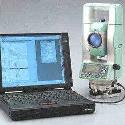
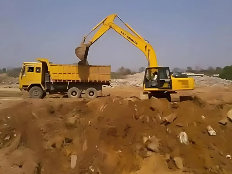
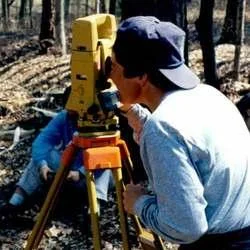
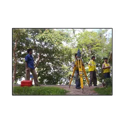
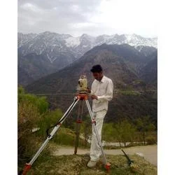
Our professional GIS and CAD survey services provide comprehensive geospatial solutions for accurate mapping and spatial data analysis. We specialize in converting physical landscapes into precise digital formats using advanced surveying technology and software. Our certified surveyors and technicians deliver reliable data collection, processing, and mapping services that form the critical foundation for infrastructure projects, urban development, and environmental management. We maintain strict quality standards throughout every project phase, ensuring clients receive data meeting technical specifications and regulatory requirements.

These services are extensively used across construction, urban planning, telecommunications, and environmental management industries. Construction firms rely on our accurate land surveys and topographic mapping for site planning and development. Municipalities and government agencies utilize our GIS services for urban planning and infrastructure management. Environmental consultants depend on our spatial data for impact assessments, while telecommunications companies use our mapping for network planning. The mining and agricultural sectors also benefit from our surveying capabilities for resource mapping and land management.

Our services deliver significant value through improved project accuracy, reduced planning errors, and enhanced decision-making capabilities. The reliability of our survey data helps clients avoid costly mistakes and project delays, saving time and resources. We differentiate through quality assurance, customization options, and timely delivery. Our team maintains current industry knowledge and technological advancements, ensuring clients receive effective surveying solutions. We build long-term relationships based on trust and consistent performance as the preferred partner for dependable geospatial services.

Key Features:
- Advanced GPS and total station technology for precise data collection
- Customized CAD drafting services tailored to specific project requirements
- Comprehensive GIS mapping and spatial analysis capabilities
- Quality assurance protocols ensuring data accuracy and reliability
- Experienced team of certified surveyors and technical professionals

Benefits:
- Improved project accuracy and reduced planning errors for better outcomes
- Enhanced decision-making capabilities through reliable spatial data
- Time and resource savings by avoiding costly mistakes and delays
- Compliance with technical specifications and regulatory requirements
- Long-term partnership based on consistent performance and trust
Specifications
| Additional Information | |
|---|---|
| Country of Origin | India |
| Customisable | No |
Application
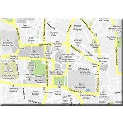
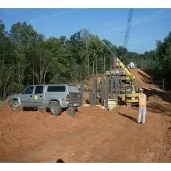
Our GIS and CAD survey services deliver precise geospatial data collection and mapping using advanced technology for accurate land surveys, topographic mapping, and spatial analysis that meets professional standards. We ensure detailed attention from initial survey to final CAD drafting and GIS implementation across diverse project requirements and geographical conditions. These services support infrastructure development, urban planning, and environmental management with reliable data forming the foundation for successful project execution by architects, engineers, and planners.

Real-world applications:
- Land development projects requiring precise boundary surveys and topographic mapping
- Urban planning and municipal infrastructure development using spatial data analysis
- Construction site planning and monitoring with accurate CAD drawings and measurements
- Environmental impact assessments through detailed geographical information systems
- Utility mapping and infrastructure management for telecommunications and energy sectors
Trade Details
| Available Stock | In stock |
| Sample Availability | No |
Payment Terms
| Payment Terms |
|
Company Profile
A One Associates, Punjab
 Punjab, India
Factory Details
Factory SizeBelow 1000 sqm
Annual Production Capacity0
Professional GIS And CAD Survey Services For Accurate Mapping
Professional GIS and CAD survey services deliver accurate mapping, land surveys, and spatial data analysis for construction, urban planning, and infrastructure projects with reliable, customized solutions.
Min. Order Quantity: 1 units
Shipping
Shipping fee and delivery date to be negotiated. Contact supplier now for more details.
A One Associates Punjab, India