undefined

Similar Products


Description
Our professional digital land survey services employ cutting-edge technology to deliver highly accurate geospatial data for critical project applications. We maintain rigorous qual...
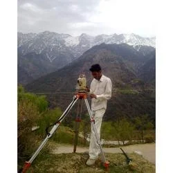
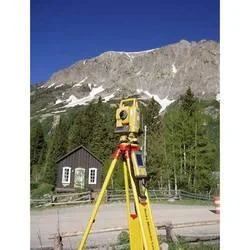
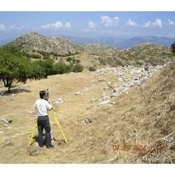
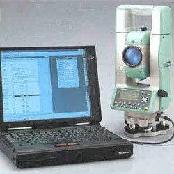
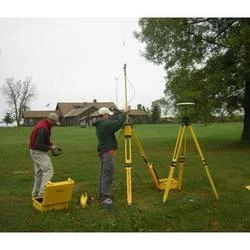
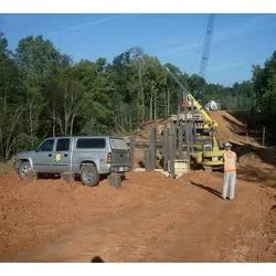
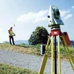
Our professional digital land survey services employ cutting-edge technology to deliver highly accurate geospatial data for critical project applications. We maintain rigorous quality standards throughout the surveying process, ensuring precise topographic information, boundary demarcation, and elevation data collection. Our experienced team utilizes advanced equipment and proven methodologies to capture comprehensive land information that serves as the reliable foundation for successful project execution. The service outputs are designed to meet diverse project requirements with consistent accuracy and reliability across various applications.

These survey services are extensively utilized in construction industries for comprehensive site planning and development projects, providing essential data for foundation work and infrastructure placement. Defense sectors rely on our precise mapping for strategic installation planning and security infrastructure development. Educational institutions benefit from our surveys for campus expansion and facility planning, while irrigation projects utilize our elevation data for efficient water management system design. Mining operations depend on our accurate surveys for resource extraction planning, site management, and operational safety compliance across extraction sites.

Organizations choose our digital land survey services for their proven reliability, exceptional precision, and adaptability to complex project requirements. The quality-controlled output ensures professionals can make confident decisions based on accurate land data, significantly reducing project risks and optimizing resource allocation. Our commitment to technological excellence and consistent quality assurance establishes us as a trusted partner for organizations requiring dependable geospatial information for critical infrastructure and development initiatives. The service delivers measurable value through time savings, risk reduction, and improved project outcomes.

Key Features:
- Advanced surveying technology for precise data collection
- Multiple output formats and detailed specifications
- Comprehensive quality control standards implementation
- Complete topographic and boundary survey capabilities
- Adaptable to various project scales and complexity levels

Benefits:
- Accurate data for informed project decision-making
- Reduced project risks through reliable information
- Optimized resource allocation and planning efficiency
- Consistent quality across all project types and sizes
- Technical expertise supporting complex requirements
Specifications
| Additional Information | |
|---|---|
| Country of Origin | India |
| Customisable | No |
Application
Our digital land survey services provide accurate geospatial data essential for infrastructure development and land assessment projects. Using advanced surveying technology, we deliver precise topographic maps, boundary surveys, and elevation models that meet rigorous industry standards. This data forms the critical foundation for successful project planning and execution across multiple sectors requiring reliable land information.

Professional survey data supports informed decision-making in engineering and development projects with adaptable outputs for specific requirements. The service offers various data formats and detail levels suitable for both large-scale industrial applications and specialized projects demanding high precision. This flexibility ensures optimal results regardless of project scope or complexity while maintaining consistent data quality.
- Construction site planning and development projects
- Defense infrastructure and strategic installation mapping
- Educational campus development and expansion planning
- Irrigation system design and water management projects
- Mining operations and resource extraction site mapping
Trade Details
| Available Stock | In stock |
| Sample Availability | No |
Payment Terms
| Payment Terms |
|
Company Profile
A One Associates, Punjab
 Punjab, India
Factory Details
Factory SizeBelow 1000 sqm
Annual Production Capacity0
Professional Digital Land Survey Services For Construction And Mining
Professional digital land survey services deliver precise geospatial data for construction, mining, irrigation, and defense projects using advanced technology with strict quality control for reliable project planning.
Min. Order Quantity: 1 units
Shipping
Shipping fee and delivery date to be negotiated. Contact supplier now for more details.
A One Associates Punjab, India