undefined
Similar Products


Description
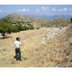
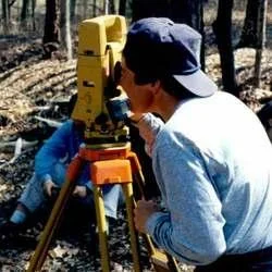
Our professional contour survey services utilize precision total station technology to deliver accurate elevation data and detailed terrain mapping for land development and constru...
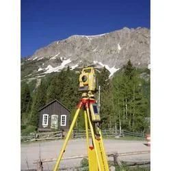
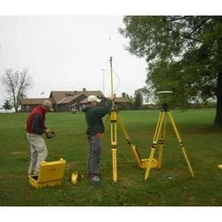
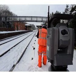
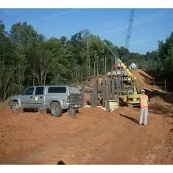
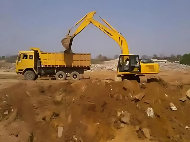
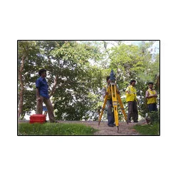
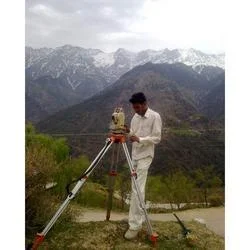
Our professional contour survey services utilize precision total station technology to deliver accurate elevation data and detailed terrain mapping for land development and construction projects. We specialize in capturing precise ground contours that form the essential foundation for engineering design, construction planning, and regulatory compliance. Our team of experienced surveyors ensures meticulous attention to detail, providing reliable data that architects, engineers, and project managers trust for critical decision-making processes. We understand that accurate contour information is vital for successful project execution, which is why we employ state-of-the-art equipment and methodologies to deliver results meeting the highest industry standards.

These contour survey services serve multiple industries including civil engineering, construction, urban planning, and environmental management. Civil engineers depend on our precise contour data for road design, drainage systems, and infrastructure development projects. Construction companies utilize our surveys for site preparation, grading verification, and foundation planning. Urban planners employ our contour mapping for zoning decisions, land development projects, and municipal planning initiatives. Environmental consultants use our services for watershed management, erosion control planning, and environmental impact assessments. The mining industry also benefits from our contour surveys for volume calculations, slope stability analysis, and operational planning.

The business value of our contour survey services lies in their ability to reduce project risks, optimize resource allocation, and ensure regulatory compliance. By providing accurate terrain data upfront, we help clients avoid costly design changes, construction delays, and potential legal issues. Our reliable surveys enable better project planning, more efficient material usage, and improved safety considerations. This commitment to quality and reliability has established us as a trusted partner for businesses that depend on precise spatial data for their operational success and project viability across various sectors and applications.

Key Features:
- Advanced total station technology for high-precision measurements
- Comprehensive contour mapping with detailed elevation data
- Professional surveyors with extensive industry expertise
- Accurate point layout and terrain modeling capabilities
- Reliable data collection and processing methodologies

Benefits:
- Reduced project risks through accurate terrain information
- Optimized resource allocation and material planning
- Enhanced construction safety and compliance assurance
- Improved project efficiency and timeline management
- Trusted data for critical engineering decisions
Specifications
| Additional Information | |
|---|---|
| Country of Origin | India |
| Customisable | No |
Application
Our professional contour survey services deliver precise elevation mapping using advanced total station technology for construction planning and land development. These accurate terrain models form the foundation for engineering designs, site preparation, and infrastructure projects requiring reliable spatial data across various industries and applications.

These surveying solutions support multiple sectors including civil engineering, urban development, and environmental management. The detailed contour data enables professionals to make informed decisions about land utilization, project feasibility, and regulatory compliance while optimizing resource allocation and ensuring construction accuracy across diverse project types and scales.
- Construction site grading verification and foundation preparation
- Road and highway design with precise gradient planning
- Residential and commercial land development projects
- Environmental assessments and watershed management
- Mining operations for volume calculations and slope analysis
Trade Details
| Available Stock | In stock |
| Sample Availability | No |
Payment Terms
| Payment Terms |
|
Company Profile
A One Associates, Punjab
 Punjab, India
Factory Details
Factory SizeBelow 1000 sqm
Annual Production Capacity0
Professional Contour Survey Services For Land Development And Construction
Professional contour survey services using precision total stations deliver accurate land topography mapping for construction, infrastructure development, and land planning projects requiring reliable elevation data.
Min. Order Quantity: 1 units
Shipping
Shipping fee and delivery date to be negotiated. Contact supplier now for more details.
A One Associates Punjab, India