undefined

Similar Products


Description
Our professional contour survey services deliver precise topographic mapping through advanced elevation measurement techniques. We create detailed contour maps that accurately repr...
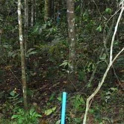
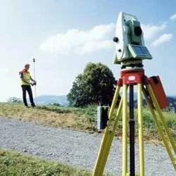
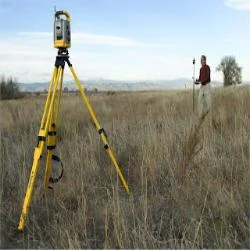
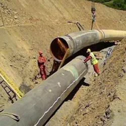
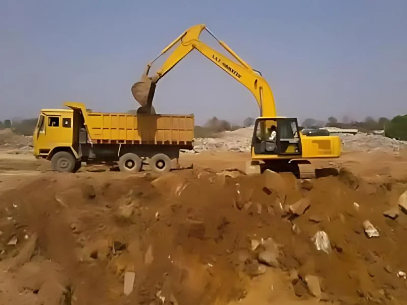
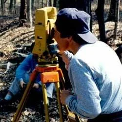
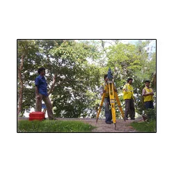
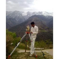
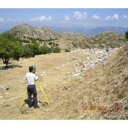
Our professional contour survey services deliver precise topographic mapping through advanced elevation measurement techniques. We create detailed contour maps that accurately represent land surfaces, showing elevation changes through contour lines connecting points of equal height. Our surveying approach utilizes state-of-the-art equipment including GPS systems, total stations, and laser scanning technology to capture comprehensive terrain data. Our team of experienced surveyors ensures every project meets the highest standards of accuracy and reliability, providing clients with essential information for informed decision-making in their development projects.

Contour surveys serve critical functions across multiple industries including construction, civil engineering, mining, and urban planning. In the construction sector, these surveys enable proper site planning, foundation design, and drainage system implementation. Civil engineering projects utilize contour data for road design, bridge construction, and infrastructure development. Mining operations depend on accurate contour mapping for volume calculations, pit design, and environmental compliance. Urban planners use this data for zoning decisions, flood plain analysis, and sustainable development planning, making contour surveys indispensable for responsible land management.

The business value of professional contour surveying lies in its ability to prevent costly errors and optimize project execution. By providing accurate elevation data before construction begins, our services help clients avoid unexpected site conditions that could lead to budget overruns and schedule delays. The reliability of our surveys ensures that engineering designs align with actual terrain conditions, reducing rework and improving overall project efficiency. Our quality control procedures guarantee measurement accuracy, delivering data that integrates seamlessly with design software and project management systems.

Key Features:
- High-precision elevation mapping using advanced GPS and laser technology
- Detailed terrain analysis with accurate contour line representation
- Experienced professional surveyors with industry-specific expertise
- Comprehensive data reporting including digital and hardcopy formats
- Strict quality control procedures ensuring measurement accuracy

Benefits:
- Prevents costly errors through accurate pre-construction terrain analysis
- Optimizes project execution with reliable elevation data
- Reduces rework by ensuring engineering designs match actual conditions
- Supports informed decision-making for development projects
- Enhances project efficiency through comprehensive terrain intelligence
Specifications
| Additional Information | |
|---|---|
| Country of Origin | India |
| Customisable | No |
Application
Contour survey services provide essential elevation data through detailed terrain mapping using contour lines. This enables engineers and project managers to visualize slopes, drainage patterns, and ground stability before project commencement. The accurate data helps prevent costly errors during earthmoving operations and ensures structural integrity throughout project execution, supporting both small-scale developments and large infrastructure initiatives with reliable terrain intelligence.

These professional surveying services serve multiple sectors including civil engineering, urban planning, and environmental management. The precise elevation measurements support critical decisions regarding foundation design, grading plans, and infrastructure placement. This technology-driven approach minimizes guesswork and provides dependable data that forms the foundation for successful project planning and execution across various land development scenarios.
- Construction site planning and grading optimization for building foundations
- Mining operations for calculating excavation volumes and stockpile management
- Road and highway engineering for slope stability analysis and drainage planning
- Land development projects for determining optimal lot layouts and terrain modifications
- Environmental monitoring and flood risk assessment through topographic mapping
Trade Details
| Available Stock | In stock |
| Sample Availability | No |
Payment Terms
| Payment Terms |
|
Company Profile
Dhyani Consultants Inc., New Delhi
 New Delhi, India
Electronics & Electrical•Distributor / WholesalerRetailerImporter / Exporter
Factory Details
Factory SizeBelow 1000 sqm
Annual Production Capacity0
Contour Survey Services For Construction And Land Development
Professional contour survey services deliver precise land elevation mapping for construction, mining, and infrastructure projects requiring detailed terrain analysis and accurate volume calculations.
Min. Order Quantity: 1 units
Shipping
Shipping fee and delivery date to be negotiated. Contact supplier now for more details.
Dhyani Consultants Inc. New Delhi, India
Electronics & ElectricalDistributor / Wholesaler