undefined

Similar Products


Description
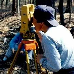
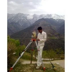
Our Professional City Survey Services provide comprehensive, high-precision land surveying solutions specifically designed for urban development and infrastructure projects. We emp...
Our Professional City Survey Services provide comprehensive, high-precision land surveying solutions specifically designed for urban development and infrastructure projects. We employ state-of-the-art technology, including advanced GPS systems, robotic total stations, and sophisticated mapping software, to capture and deliver exceptionally accurate spatial data. Our team of experienced surveyors conducts meticulous topographic surveys, definitive boundary determinations, and precise construction staking, ensuring every measurement meets the highest standards of accuracy and regulatory compliance. We work collaboratively with each client to understand unique project scopes and deliver tailored results that form a reliable basis for critical planning and construction decisions.

These surveying solutions are extensively utilized across vital sectors that shape our urban environments. Municipal and government agencies depend on our data for public infrastructure projects, urban renewal programs, and master planning. Real estate developers and property managers rely on our precise boundary and topographic surveys for acquisitions, development approvals, and site planning. Engineering and construction firms integrate our accurate measurements into the design and execution of roads, bridges, utility networks, and large-scale building projects, ensuring projects are built correctly from the ground up.

We deliver significant business value by providing reliable, trustworthy survey data that mitigates project risks, prevents costly errors, and avoids legal disputes. Our commitment to quality and precision ensures clients receive information they can confidently use for financing, design, and regulatory submissions. Our coordinated project management ensures timely delivery without compromising on detail, making us a dependable partner for serious development projects where accuracy is non-negotiable and schedules are critical.

Key Features:
- Utilization of advanced GPS, total stations, and mapping software for high-precision data collection
- Detailed topographic, boundary, and construction staking surveys conducted by expert teams
- Services tailored to meet specific project requirements and regulatory standards
- Meticulous attention to accuracy and comprehensive data reporting
- Coordinated project management ensuring reliable and timely delivery

Benefits:
- Reduces project risk and prevents costly construction errors with accurate foundational data
- Ensures regulatory compliance and smooth approval processes for development projects
- Supports efficient planning and design with reliable, detailed spatial information
- Provides a trustworthy basis for property transactions and legal documentation
- Enhances project timelines and execution with precise, actionable survey results
Specifications
| Additional Information | |
|---|---|
| Country of Origin | India |
| Customisable | No |
Application
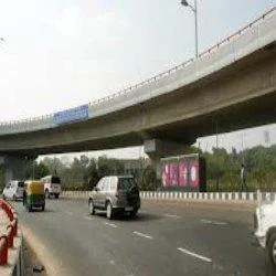
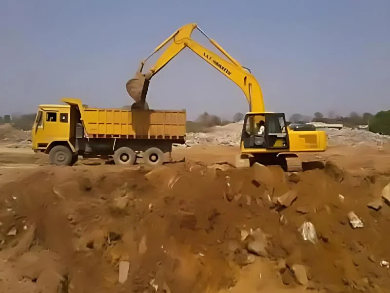
Our professional city survey services deliver precise land measurement and mapping essential for modern urban development. We provide detailed topographic data, accurate boundary surveys, and construction layout services that meet strict regulatory standards and specific project requirements, ensuring a solid foundation for any infrastructure initiative.

These services are crucial for municipal authorities, real estate developers, and construction firms managing complex projects. Our accurate spatial data enables proper land utilization, ensures compliance with zoning laws, and supports efficient project execution from initial planning through to final construction phases.
- Urban planning and municipal infrastructure development projects
- Road, highway, and public transportation network construction
- Real estate development and precise property boundary demarcation
- Utility mapping for water supply, sewage, and electrical grid systems
- Environmental impact assessments and sustainable land use planning
Trade Details
| Available Stock | In stock |
| Sample Availability | No |
Payment Terms
| Payment Terms |
|
Company Profile
Creative Engineering Services, Uttar Pradesh
 Uttar Pradesh, India
Factory Details
Factory SizeBelow 1000 sqm
Annual Production Capacity0
Professional City Survey Services For Urban Planning And Infrastructure
Professional city survey services for urban planning and infrastructure. We deliver precise land surveys using advanced technology and expert teams to support your development projects with reliable, accurate spatial data.
Min. Order Quantity: 1 units
Shipping
Shipping fee and delivery date to be negotiated. Contact supplier now for more details.
Creative Engineering Services Uttar Pradesh, India