undefined
Similar Products


Description
Our as-built drawings for highways provide comprehensive documentation of constructed highway infrastructure, capturing every detail from roadway dimensions to utility placements a...
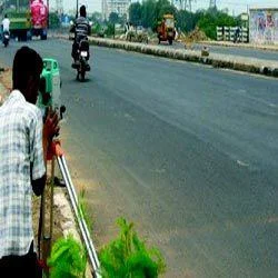
Our as-built drawings for highways provide comprehensive documentation of constructed highway infrastructure, capturing every detail from roadway dimensions to utility placements and drainage systems. These precise drawings are developed through meticulous field surveys and office analysis, ensuring they accurately reflect the actual built environment with complete dimensional accuracy. The process involves advanced surveying techniques, thorough data verification, and multiple quality control measures to deliver reliable documentation that meets industry standards and regulatory requirements. These drawings serve as the definitive record of highway construction, essential for all stakeholders involved in infrastructure development, management, and long-term maintenance planning.

Highway as-built drawings are utilized across multiple sectors including civil engineering firms, construction companies, government transportation departments, and urban planning agencies. Engineering consultancies rely on these documents for design verification, project management, and quality assurance processes. Contractors use them for construction validation and compliance documentation, while government bodies require these drawings for infrastructure maintenance, safety audits, and future development planning. The drawings also serve utility companies, environmental agencies, and emergency services that need accurate spatial information about highway infrastructure and surrounding features for operational planning and emergency response coordination.

The business value of our as-built drawings lies in their exceptional reliability, precision, and strict compliance with industry standards. These documents significantly reduce operational risks by providing verified records that prevent costly errors during maintenance, repairs, or expansion projects. Their consistent quality ensures clients receive dependable documentation that addresses specific project requirements and regulatory needs without compromise. The drawings enhance project transparency, support informed decision-making processes, and provide long-term value by serving as permanent records that protect infrastructure investments and ensure continuous regulatory compliance throughout the entire infrastructure lifecycle.

Key Features:
- Comprehensive field surveying using advanced measurement technologies
- Detailed office analysis and drawing preparation with quality assurance
- Accurate representation of all highway elements including drainage and utilities
- Compliance with industry regulations and documentation standards
- Meticulous verification processes ensuring dimensional accuracy

Benefits:
- Reduces operational risks by preventing costly errors in maintenance
- Ensures regulatory compliance with accurate documentation
- Supports informed decision-making for infrastructure projects
- Provides long-term value as permanent infrastructure records
- Enhances project transparency and quality assurance processes
Specifications
| Additional Information | |
|---|---|
| Country of Origin | India |
| Customisable | No |
Application
Our as-built highway drawings serve as critical documentation capturing exact constructed conditions including roadway dimensions, drainage systems, signage placements, and utility integrations. These precise records ensure all project specifications are accurately represented for regulatory compliance, maintenance planning, and future development requirements across transportation infrastructure projects.

These drawings are indispensable throughout the highway lifecycle, from initial construction verification to long-term maintenance and expansion planning. They provide contractors, civil engineers, and government authorities with reliable reference documents that support asset management, safety evaluations, and infrastructure upgrades while meeting all statutory documentation and compliance requirements.
- Verification of constructed highway elements against original design specifications
- Maintenance planning and infrastructure management for transportation departments
- Regulatory compliance documentation for government approvals and audits
- Future expansion and modification planning based on accurate existing conditions
- Insurance and legal documentation for dispute resolution and liability assessment
Trade Details
| Available Stock | In stock |
| Sample Availability | No |
Payment Terms
| Payment Terms |
|
Company Profile
Creative Engineering Services, Uttar Pradesh
 Uttar Pradesh, India
Factory Details
Factory SizeBelow 1000 sqm
Annual Production Capacity0
As Built Highway Drawings For Infrastructure Projects And Compliance
Professional as-built highway drawings provide accurate post-construction documentation for infrastructure projects. Essential for civil engineers, contractors, and government agencies requiring precise records of built highway conditions and specifications.
Min. Order Quantity: 1 units
Shipping
Shipping fee and delivery date to be negotiated. Contact supplier now for more details.
Creative Engineering Services Uttar Pradesh, India