E Surveying Softech ( India ) Private Limited

Product Range
Fact Sheet
- Location:Karnataka, India
- Year of Establishment:2011
- Business Type:Business Services
- Main Products:Contour Software, Quantity Calculation Software
- Reviews & Rating:

Get Verified, Sell more with
- Buyer's trust
- Faster conversions
- Better Rankings
- More
Its Free
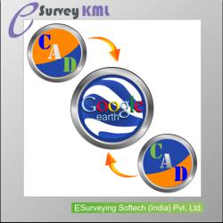
Verify NowGoogle Earth To CAD KML Software
Google Earth is a geo-browser which represents the Earth as a three-dimensional globe.
- FOB PriceNA
- Min Order QuantityNA
- Payment TermsNA

Other Details
E Survey KML
Google Earth is a geo-browser which represents the Earth as a three-dimensional globe. It is great tool to Explore Earth Imagery. On the other side CAD Package which works with UTM is more convenient to represent 2-D Drawings. Converting data available in Google earth in the form of KML File to 2 Dimensional drawing data and Vice Versa is possible with E Survey KML.
E Survey KML (Export) – Export your CAD Data to Google Earth readable format (KML File)
E Survey KML (Import) – Import Places information from Google Earth KML File to your CAD Package
Key Features of E Survey KML:
Export CAD Drawing to KML File (Point (Place Marker), Text, Line, Pline (Path), Polygon)
Import KML File data as CAD Drawing (Point (Place Maker), Text, Line, Pline (Path), Polygon)
Convert UTM Coordinate to Lat Long
Convert Lat Long Coordinate to UTM
Find Lat long of a Point with in your CAD Editor
Benefit of E Survey KML:
Present your Drawing data on Google Earth and Impress your Customer
Cross Check Survey Data with Google Earth Data to ensure accuracy
Import Available Data from KML File and avoid retracing.
Images