𝗪𝗵𝗮𝘁 𝗮𝗿𝗲 𝗧𝗼𝗽𝗼𝗴𝗿𝗮𝗽𝗵𝗶𝗰𝗮𝗹 𝗦𝘂𝗿𝘃𝗲𝘆 𝗦𝗲𝗿𝘃𝗶𝗰𝗲𝘀?
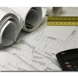
Topographical survey services involve the detailed mapping and analysis of the terrain and features of a specific land area. These services utilize advanced surveying techniques and technology to collect data on the elevation, contours, and physical characteristics of the land. The resulting topographical maps and digital models provide valuable insights that are essential for planning and decision-making in various projects.
These services are primarily used in industries such as construction, civil engineering, land development, and environmental studies. They help businesses assess the suitability of land for specific uses, plan site layouts, and identify potential challenges related to topography. Additionally, accurate topographical surveys are crucial for obtaining permits and ensuring compliance with local regulations. As urbanization and infrastructure development continue to grow, the demand for topographical survey services remains significant within the market.
𝗞𝗲𝘆 𝗙𝗲𝗮𝘁𝘂𝗿𝗲𝘀 𝗮𝗻𝗱 𝗦𝗽𝗲𝗰𝗶𝗳𝗶𝗰𝗮𝘁𝗶𝗼𝗻𝘀
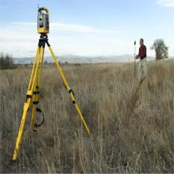
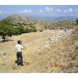
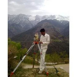
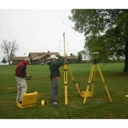
Topographical survey services are characterized by their precision and comprehensive data collection methods. These services often employ technologies such as GPS, LiDAR, and traditional surveying tools to ensure accuracy.
Key specifications include:
1. Surveying Methods
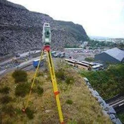
- Combination of GPS, total stations, and aerial surveys
- Accuracy levels typically within a few centimeters
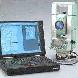
2. Data Formats
- Deliverables include 2D maps and 3D digital models
- Compatible with various design software for easy integration
3. Coverage Area
- Services available for small plots to large-scale landscapes
- Customizable survey areas based on client requirements
4. Spatial Resolution
- High-resolution data for detailed topographical features
- Capability to identify and map small features like trees and buildings
5. Project Turnaround Time
- Quick data collection and analysis
- Standard delivery times range from a few days to several weeks, depending on project size
6. Regulatory Compliance
- Services adhere to local surveying standards and regulations
- Ensures compliance with environmental and zoning laws
7. Data Accuracy and Quality
- High-quality data validated through rigorous checks
- Quality assurance processes in place to maintain standards
Topographical survey services are vital for ensuring that businesses have the precise information needed for effective planning and execution of projects.
𝗖𝗼𝗺𝗺𝗼𝗻 𝗔𝗽𝗽𝗹𝗶𝗰𝗮𝘁𝗶𝗼𝗻𝘀 𝗮𝗻𝗱 𝗨𝘀𝗲 𝗖𝗮𝘀𝗲𝘀
Topographical survey services find extensive applications across various industries.
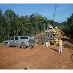
1. Construction: These surveys provide critical data for site planning, grading, and foundation design, ensuring that construction projects are built on solid ground.
2. Civil Engineering: Engineers rely on topographical data to design roads, bridges, and other infrastructure, considering the terrain's impact on project feasibility.
3. Environmental Studies: Surveys help assess the impact of projects on ecosystems and inform land-use planning to protect natural resources.
4. Mining: Topographical surveys are essential for mapping mineral deposits and planning extraction activities in a way that minimizes environmental impact.
5. Agriculture: Farmers and land developers use topographical data to optimize land use, manage irrigation systems, and improve crop yields.
6. Urban Planning: City planners utilize topographical surveys to develop land-use plans, zoning regulations, and infrastructure projects.
7. Real Estate Development: Developers use these surveys to assess property potential, understand land features, and inform buyers about land characteristics.
𝗣𝗿𝗼𝗱𝘂𝗰𝘁 𝗩𝗮𝗿𝗶𝗮𝗻𝘁𝘀 𝗮𝗻𝗱 𝗦𝘂𝗯𝗰𝗮𝘁𝗲𝗴𝗼𝗿𝗶𝗲𝘀
Topographical survey services can come in various forms, each tailored to specific needs.
Standard Survey Services
These are comprehensive surveys that cover all aspects of topographical data collection, suitable for large projects requiring detailed analysis.
Aerial Survey Services
Utilizing drones and aerial imagery, these services are effective for vast areas. They provide rapid data collection and high-resolution images for analysis.
GPS Survey Services
Focusing on precise positioning, these surveys are ideal for projects that require exact location data for construction or mapping.
3D Modeling Services
These services convert traditional survey data into interactive 3D models, enhancing visualization for stakeholders involved in design and planning.
𝗕𝗲𝗻𝗲𝗳𝗶𝘁𝘀 𝗮𝗻𝗱 𝗔𝗱𝘃𝗮𝗻𝘁𝗮𝗴𝗲𝘀
Topographical survey services offer numerous benefits to businesses looking to enhance project outcomes.
1. Enhanced Accuracy: These surveys provide precise data, reducing the risk of costly mistakes during project execution.
2. Better Planning: Comprehensive topographical information enables better decision-making and project planning, improving overall efficiency.
3. Regulatory Compliance: Accurate surveys help businesses adhere to local regulations, avoiding potential legal issues and delays.
4. Cost-Effectiveness: Investing in quality surveys upfront can lead to significant savings by preventing unforeseen complications during construction.
5. Improved Collaboration: Accurate topographical data enhances communication among architects, engineers, and contractors, fostering a collaborative project environment.
6. Increased Project Success: With reliable data, projects are more likely to meet timelines and budgets, leading to higher client satisfaction.
𝗕𝘂𝘆𝗶𝗻𝗴 𝗚𝘂𝗶𝗱𝗲 𝗳𝗼𝗿 𝗕𝟮𝗕 𝗕𝘂𝘆𝗲𝗿𝘀
When sourcing topographical survey services, businesses should consider several crucial factors to ensure they select the right provider.
1. Quality Assessment: Look for companies that have a proven track record of delivering high-quality surveys. Check for client testimonials and case studies that demonstrate their expertise.
2. Supplier Verification: Vet potential suppliers thoroughly. Verify their qualifications, experience in the industry, and the technology they use for surveys.
3. Pricing and MOQ: Understand the pricing structure and minimum order quantities. Ensure that the costs align with your budget and project requirements.
4. Delivery and Lead Times: Inquire about turnaround times for survey completion and data delivery. Timely data is essential for maintaining project schedules.
5. Compliance Requirements: Ensure that the service provider adheres to all relevant regulatory standards and local surveying laws to avoid compliance issues.
𝗖𝗼𝗺𝗽𝗹𝗶𝗮𝗻𝗰𝗲 𝗮𝗻𝗱 𝗖𝗲𝗿𝘁𝗶𝗳𝗶𝗰𝗮𝘁𝗶𝗼𝗻𝘀
Topographical survey services must adhere to various quality standards and regulations to ensure accuracy and reliability. Industry certifications such as CE indicate a commitment to quality and safety in service delivery.
Compliance with ISO 9001 standards ensures that a service provider maintains a quality management system, emphasizing continuous improvement and customer satisfaction. Additionally, adherence to safety and testing requirements is crucial, particularly when surveying in sensitive or hazardous environments.
Regional compliance considerations may also be necessary, as different areas may have specific regulations governing land use and surveying practices. It is essential for businesses to partner with service providers who are knowledgeable about regional laws and standards.
𝗪𝗵𝘆 𝗦𝗼𝘂𝗿𝗰𝗲 𝗧𝗼𝗽𝗼𝗴𝗿𝗮𝗽𝗵𝗶𝗰𝗮𝗹 𝗦𝘂𝗿𝘃𝗲𝘆 𝗦𝗲𝗿𝘃𝗶𝗰𝗲𝘀 𝗳𝗿𝗼𝗺 𝗣𝗲𝗽𝗮𝗴𝗼𝗿𝗮?
Pepagora offers an exceptional platform for sourcing topographical survey services, backed by a network of verified suppliers. This ensures that buyers connect with reputable providers who meet high-quality standards.
The streamlined request for quotation (RFQ) process simplifies sourcing. Buyers can easily submit their requirements and receive competitive quotes, allowing for informed decision-making.
Pepagora also prioritizes trade assurance and support for buyers. This includes protections against potential disputes and guidance throughout the procurement process.
With regional coverage extending across India, the GCC, and Southeast Asia, Pepagora provides access to a wide range of topographical survey services tailored to meet diverse market needs. This geographic reach ensures that businesses can find suitable service providers regardless of their location.