𝗪𝗵𝗮𝘁 𝗮𝗿𝗲 𝟯𝗗 𝗟𝗮𝘀𝗲𝗿 𝗦𝗰𝗮𝗻𝗻𝗶𝗻𝗴 & 𝗟𝗶𝗗𝗔𝗥 𝗠𝗮𝗽𝗽𝗶𝗻𝗴?
3D Laser Scanning and LiDAR Mapping are advanced technologies used to capture precise measurements and create detailed three-dimensional representations of physical environments. Laser scanning utilizes laser beams to measure distances between the scanner and various points in the environment, while LiDAR (Light Detection and Ranging) employs laser pulses to calculate distances and generate high-resolution maps. Both methods enable the creation of accurate digital models that can be analyzed and manipulated for various applications.
These technologies have found significant applications across multiple sectors, including construction, engineering, mining, and environmental studies. Businesses use 3D Laser Scanning and LiDAR Mapping for site analysis, topographical surveys, and asset management. The ability to quickly and accurately gather spatial data has made these technologies essential tools for project planning and execution, enabling companies to enhance productivity and reduce errors.
As industries increasingly adopt digital transformation, the relevance of 3D Laser Scanning and LiDAR Mapping continues to grow. The market for these technologies is expanding, driven by the demand for precise data in urban planning, infrastructure development, and environmental monitoring. This evolution reflects the ongoing advancements in technology and the need for businesses to leverage data for informed decision-making.
𝗞𝗲𝘆 𝗙𝗲𝗮𝘁𝘂𝗿𝗲𝘀 𝗮𝗻𝗱 𝗦𝗽𝗲𝗰𝗶𝗳𝗶𝗰𝗮𝘁𝗶𝗼𝗻𝘀
3D Laser Scanning and LiDAR Mapping systems boast a range of features that enhance their effectiveness in capturing detailed spatial data. These specifications are crucial for businesses looking to invest in reliable and accurate mapping solutions.
Key specifications include:
1. Measurement Range
- Capable of measuring distances from a few centimeters to several kilometers
- Ensures versatility for various project sizes and environments
2. Accuracy
- Offers centimeter-level accuracy for precise data collection
- Critical for applications requiring high precision
3. Point Cloud Density
- Generates millions of data points per scan
- Provides detailed 3D representations for analysis
4. Scan Speed
- Capable of capturing data quickly, often within minutes
- Increases efficiency in project timelines
5. Data Format Compatibility
- Supports multiple data formats for easy integration with software
- Facilitates seamless data exchange between platforms
6. Operational Range
- Functions in diverse environmental conditions, including low light
- Enhances usability in various terrains
7. Weight and Portability
- Lightweight designs for easy transport and setup
- Ideal for fieldwork and remote locations
8. Battery Life
- Equipped with extended battery life for prolonged usage
- Minimizes downtime during field operations
These features collectively contribute to the effectiveness and reliability of 3D Laser Scanning and LiDAR Mapping technologies, making them indispensable tools in various industries.
𝗖𝗼𝗺𝗺𝗼𝗻 𝗔𝗽𝗽𝗹𝗶𝗰𝗮𝘁𝗶𝗼𝗻𝘀 𝗮𝗻𝗱 𝗨𝘀𝗲 𝗖𝗮𝘀𝗲𝘀
3D Laser Scanning and LiDAR Mapping technologies serve numerous industries, providing tailored solutions for specific needs.
1. Construction: These technologies are widely used for site surveys and monitoring construction progress, allowing for improved project management and accuracy in measurements.
2. Engineering: Engineers utilize 3D models for design validation and structural analysis, ensuring that projects meet safety and performance standards.
3. Mining: LiDAR mapping is employed for geological surveys and resource management, helping companies optimize extraction processes and minimize environmental impact.
4. Environmental Studies: Researchers use these technologies to monitor changes in landscapes and ecosystems, aiding in conservation efforts and environmental assessments.
5. Architecture: Architects rely on detailed scans for heritage preservation and renovation projects, enabling accurate restoration of historical buildings.
6. Oil and Gas: These technologies facilitate pipeline inspections and facility mapping, enhancing safety and operational efficiency.
7. Urban Planning: City planners use LiDAR data for infrastructure development and urban modeling, improving city layouts and transportation systems.
𝗣𝗿𝗼𝗱𝘂𝗰𝘁 𝗩𝗮𝗿𝗶𝗮𝗻𝘁𝘀 𝗮𝗻𝗱 𝗦𝘂𝗯𝗰𝗮𝘁𝗲𝗴𝗼𝗿𝗶𝗲𝘀
3D Laser Scanning and LiDAR Mapping technologies come in various forms, catering to different applications and user needs.
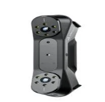
Portable LiDAR Scanners: These compact devices are designed for field use, allowing for quick data collection and easy transport. They are ideal for projects requiring mobility and flexibility.
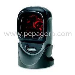
Terrestrial Laser Scanners: These fixed-location scanners provide high-resolution data for detailed land surveys. They are commonly used in construction and civil engineering applications for their precision.
Aerial LiDAR Systems: Mounted on drones or aircraft, these systems capture large areas quickly and efficiently. They are perfect for environmental monitoring and topographic mapping.
𝗕𝗲𝗻𝗲𝗳𝗶𝘁𝘀 𝗮𝗻𝗱 𝗔𝗱𝘃𝗮𝗻𝘁𝗮𝗴𝗲𝘀
Investing in 3D Laser Scanning and LiDAR Mapping offers key benefits that enhance operational efficiency and project outcomes.
1. Enhanced Accuracy: These technologies provide precise measurements, reducing errors in project planning and execution.
2. Time Efficiency: Quick data collection allows for faster project completion, minimizing delays and associated costs.
3. Comprehensive Data Capture: The ability to gather extensive data points leads to more informed decision-making and better resource management.
4. Improved Safety: Accurate mapping helps identify potential hazards in project sites, contributing to safer working conditions.
5. Cost Savings: By reducing the need for rework and improving project efficiency, businesses can save significantly on overall costs.
6. Versatile Applications: The adaptability of these technologies allows for use across multiple industries, increasing their value to businesses.
𝗕𝘂𝘆𝗶𝗻𝗴 𝗚𝘂𝗶𝗱𝗲 𝗳𝗼𝗿 𝗕𝟮𝗕 𝗕𝘂𝘆𝗲𝗿𝘀
When sourcing 3D Laser Scanning and LiDAR Mapping technologies, it is essential to consider various factors to ensure the best fit for your needs.
1. Quality Assessment: Evaluate the accuracy and resolution of the scanning technology. Look for models that meet industry standards and provide reliable data.
2. Supplier Verification: Vet suppliers based on their reputation and experience in the field. Consider customer reviews and case studies to assess their credibility.
3. Pricing and MOQ: Understand the pricing structure and minimum order quantities. Compare different suppliers to find competitive rates without compromising quality.
4. Delivery and Lead Times: Inquire about delivery schedules and lead times. Ensure that the supplier can meet your project timelines.
5. Compliance Requirements: Check for any regulatory needs or industry certifications, such as CE certification, to ensure compliance with regional standards.
𝗖𝗼𝗺𝗽𝗹𝗶𝗮𝗻𝗰𝗲 𝗮𝗻𝗱 𝗖𝗲𝗿𝘁𝗶𝗳𝗶𝗰𝗮𝘁𝗶𝗼𝗻𝘀
3D Laser Scanning and LiDAR Mapping technologies must adhere to relevant quality standards and certifications to ensure reliability and safety. ISO 9001 is a key standard that emphasizes quality management systems, ensuring that manufacturers meet consistent quality benchmarks.
Additionally, CE certification indicates that products comply with European safety and environmental requirements, ensuring they are safe for use. These certifications provide buyers with confidence in the quality and performance of the technologies.
Safety and testing requirements are also paramount in the development of these systems. Regular assessments and compliance checks help maintain high standards of safety and operational efficiency.
Regional compliance considerations may vary, so it is important for businesses to be aware of local regulations that may affect the use of 3D Laser Scanning and LiDAR Mapping technologies.
𝗪𝗵𝘆 𝗦𝗼𝘂𝗿𝗰𝗲 𝟯𝗗 𝗟𝗮𝘀𝗲𝗿 𝗦𝗰𝗮𝗻𝗻𝗶𝗻𝗴 & 𝗟𝗶𝗗𝗔𝗥 𝗠𝗮𝗽𝗽𝗶𝗻𝗴 𝗳𝗿𝗼𝗺 𝗣𝗲𝗽𝗮𝗴𝗼𝗿𝗮?
Pepagora serves as a trusted platform for sourcing 3D Laser Scanning and LiDAR Mapping technologies, offering several key advantages for buyers.
Verified Supplier Network: Pepagora ensures that all suppliers are thoroughly vetted for reliability and quality. This verification process fosters trust between buyers and suppliers, facilitating smoother transactions.
Streamlined RFQ Process: The platform simplifies the Request for Quotation (RFQ) process, enabling buyers to receive competitive quotes quickly. This efficiency helps businesses make informed purchasing decisions.
Trade Assurance and Support: Pepagora provides trade assurance to protect buyers, ensuring that they receive the products and services as promised. The platform also offers support throughout the purchasing process.
Regional Coverage: With a focus on markets in India, the Gulf Cooperation Council (GCC), and Southeast Asia, Pepagora effectively connects buyers with local suppliers, enhancing accessibility and reducing logistics challenges.