undefined
Apparel & Fashion
Loading subcategories...
View More

Description
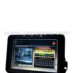
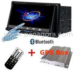
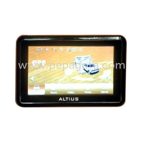
Professional GPS navigation devices provide comprehensive coverage across 336 cities and expanding territories, specifically engineered for commercial fleet operators and logistics...
Professional GPS navigation devices provide comprehensive coverage across 336 cities and expanding territories, specifically engineered for commercial fleet operators and logistics providers. These advanced units feature extensive databases including 10,00,000 points of interest and 5,00,000 village points, ensuring complete geographical coverage for business operations. With tele atlas as the primary map provider and quarterly updates, users access the most current road networks and navigation data available. The system incorporates clear audible driving directions through text-to-speech technology, spoken street names, and large, easily readable displays that minimize driver distraction while maximizing road safety during commercial operations.

These navigation systems serve critical roles across multiple industries, particularly in transportation, logistics, and supply chain management sectors. Fleet management companies utilize them for continuous vehicle tracking and efficient route planning, significantly reducing fuel consumption and improving delivery timeframes. Logistics organizations depend on the accurate, regularly updated maps to navigate complex national, state, and district highway systems seamlessly. Industries with extensive field operations, including utility services and emergency response teams, employ these devices to coordinate mobile units and respond effectively to rapidly changing situations and service requirements.

The business value of these GPS navigation devices centers on their proven reliability and consistent performance, which are fundamental differentiators in commercial markets. Engineered for durability and long-term operation, they significantly reduce operational downtime while enhancing workforce productivity. The real-time traffic updates and internet connectivity for point-of-interest searches enable businesses to adapt instantly to changing road conditions, avoiding delays and optimizing routes continuously. This operational reliability translates directly into reduced operational costs, improved customer satisfaction through timely service delivery, and stronger return on investment for organizations seeking dependable long-term navigation solutions.

Key Features:
- Comprehensive coverage across 336+ cities with ongoing territorial expansion
- Extensive database with 10,00,000 points of interest and 5,00,000 village points
- Tele atlas mapping system updated every three months for current road data
- Audible driving directions featuring text-to-speech technology and spoken street names
- Real-time traffic updates and internet connectivity for dynamic POI searches

Benefits:
- Enhanced route optimization reducing fuel costs and improving delivery efficiency
- Regular map updates ensuring accurate navigation across expanding territories
- Clear audio directions minimizing driver distraction and improving safety
- Reliable performance reducing operational downtime and maintenance costs
- Real-time adaptability to changing road conditions preventing delivery delays
Specifications
| Additional Information | |
|---|---|
| Country of Origin | India |
| Customisable | No |
Application
Our GPS navigation devices deliver reliable performance for commercial fleet operators and logistics companies requiring precise real-time tracking and route optimization. These units support large-scale deployments with robust features designed for seamless integration into existing management systems, ensuring operational continuity across diverse transportation networks.

With extensive coverage across 336 cities and detailed village databases, these devices are essential for long-haul transport, last-mile delivery services, and mobile workforce coordination. The tele atlas maps, updated quarterly, provide critical accuracy for time-sensitive operations while reducing delays and improving route efficiency across national and regional road networks.
- Fleet management operations for real-time vehicle monitoring and dynamic route planning
- Logistics coordination ensuring timely deliveries through optimized navigation paths
- Public transport systems maintaining schedule adherence and operational safety
- Emergency service vehicles requiring rapid response routing and location precision
- Field service management enabling efficient technician dispatch and job completion
Trade Details
| Available Stock | In stock |
| Sample Availability | No |
Payment Terms
| Payment Terms |
|
Company Profile
Altius Technologies Delhi, New Delhi
 New Delhi, India
Automotive & Transport•ManufacturerRetailerImporter / Exporter
Factory Details
Factory SizeBelow 1000 sqm
Annual Production Capacity0
Professional GPS Navigation Devices For Fleet Management And Logistics
Professional GPS navigation devices for fleet management and logistics, covering 336+ cities with real-time traffic updates, TTS directions, and quarterly map upgrades for reliable commercial operations.
Min. Order Quantity: 1 units
Shipping
Shipping fee and delivery date to be negotiated. Contact supplier now for more details.
Altius Technologies Delhi New Delhi, India
Automotive & TransportManufacturer