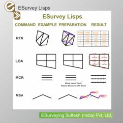
ESurvey Lisps
CAD (AutoCAD / BricsCAD / GStarCAD/ ZwCAD) users have their own set of lisps for automation, which saves a lot of time. But searching for a suitable lisp from this set of lisps is difficult. Also, most of these lisps are freely available on the Internet or custom made and hence are not properly documented. To address these issues, 'ESurvey Lisps' has been developed which includes
'ESurvey Lisps' is a collection of tailor-made lisp routines developed exclusively for CAD users working on survey drawing. Hence, it is rightly called Energizing Survey Drawings.
Key Features:
Access all Survey related macros from single elegantly defined menu.
All the lisps are tested thoroughly and well documented.
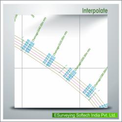
Lisps are classified into 18 categories ranging from text to interpolation.
Benefits:
Saves considerable time while working with Survey Drawings.
Increases the output drawing quality to a great extent.
Lisp Categories:
Text
Rotate, change angle or align texts with respect to selected text or parallel to line. Change case and justification.
Text Value Modification
Interchange text; create new text and copy reference text to all other selected text and insert the sequential numbers.
Lines
Join points or blocks and find overlapping lines.
Polylines
Convert connected lines to Polyline, reverse and measure each segment and cumulative distance of Polyline.
3D Polyline
Create 3D line by selecting elevation texts. Also, remove z value of all the vertex of a Polyline
Layer
Pick the text for layer name; move each text of specified layer individually. Show layer by layer.
Blocks
Insert block at the end point or at intersection or between selected points.
Select
Initiate jump to text of same layer and other text. Select entities within a polygon.
Import and Export
Extract text within polygon boundary and export selected objects to CSV file and import text from CSV file as AutoCAD points.
Print Ready
Bulk print drawing, rotate text and block as well as scale text and block.
Area
Find parcel and triangles area and populate parcel area find area of multiple objects.
Mathematics and Statistics
Find basic statistics of the selected texts and also insert the summation for the selected texts.
Elevate
Create 3D points and elevation text. Elevate selected objects.
Utilities
Measure distance, draw grid, and show entities of specified colour.
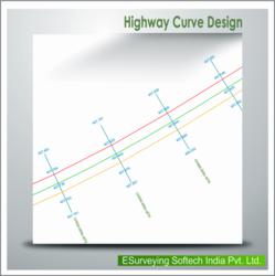
Survey Utilities
Draw grid, snap text to nearest point the grid, find lat long of selected text, do traverse correction, and represent sea-level type elevation representation.
Setting Out
Put leader with easting and northing, mark leaders, put easting northing, mark as well as export EN blocks, export vertex.
Cad cam consultant providing cad cam designing services which includes e survey cad services, earth work services, generating topological maps, calculating earthwork quantities and e topo drawing services.
More details:View company website
Its Free
Verify Now


 users have their own set of lisps for automation, which saves a lot of time. )